Upcoming lecture will discuss how photography played a crucial role at Arches and Canyonlands
Moab’s national parks—Arches and Canyonlands—owe part of their founding to photography: the medium was a way for conservationists to show the beauty of these areas to Congress over in Washington, D.C. Today, photos of the national parks are shared prolifically on social media in both positive ways—inspiring people to travel and get outside—and negative—prompting overuse of delicate areas if a photo goes viral.
Kat Connelly, a backcountry ranger with the National Park Service, will discuss photography’s role in the national parks during a free lecture on Thursday, September 7 at the Moab Information Center.

Connelly has been working for the NPS since 2018; she’s been in Moab specifically since the latter half of 2019. She’s a hobbyist photographer, and currently, shoots most of her photos in film—she loves the way it forces her to slow down to think about each shot, she said. Connelly first became interested in the relationship between photography and the parks during an internship as a photo archives technician at Yosemite: There, she digitized and organized the park’s collection of analog photos.
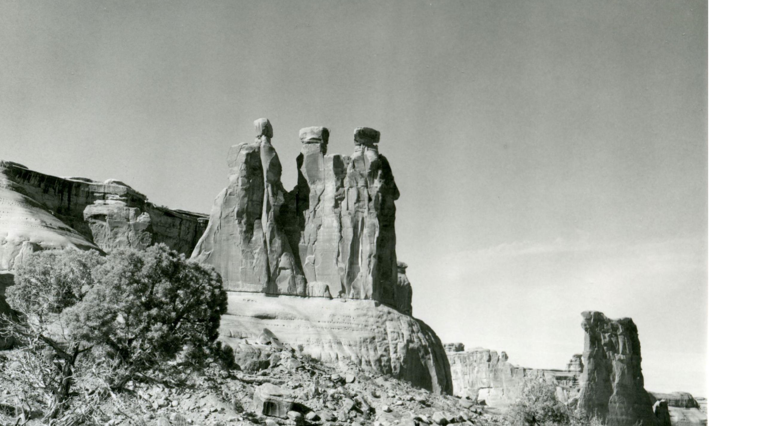
During the Thursday lecture, she’ll display a number of historical photographs of both Arches and Canyonlands, and describe photography’s timeline.
“We’ve gone from this period of time where a lot of people had not seen the West—they’d only seen it in paintings of these grand landscapes. We got to photography, and then were able to disseminate photos in newspapers or journals,” Connelly said. “Now we’re in the next iteration, where there’s so much spreading of imagery: Is that a pro or a con as we move into thinking of new ways to energize people about land conservation and recreating responsibly?”

Connelly said it was easier to find historic photos of Canyonlands than it was of Arches—Arches was established in 1929, when photography wasn’t as popular; Canyonlands in 1964. She found images through NPS archives, the U.S. Geological Survey, and the Denver Public Library: She mostly looked for images from surveys that worked to establish the parks.
But she’ll also discuss the role social media photography plays. Both Canyonlands and Arches have their own social media accounts and often share modern photos of beautiful views and recreation options—and photos of the parks are shared by visitors. While those photos are aimed at inspiring visitors, sometimes social media can cause an influx of photographers to areas that are more sensitive to visitation. There’s a relatively new movement, Connelly said, to not geo-tag photos shared on any social media—but that also requires a careful balance of not gatekeeping certain areas.

Even if you’re not interested in the discussion of pros and cons, Connelly said, definitely come for the historic photos: she’s loved looking through photos of old cars driving the White Rim and people’s historic tourist outfits.
“There’ll be a really good collection to see,” she said.
The lecture will take place on Thursday, September 7 at 5 p.m. at the Moab Information Center as part of the MIC and Canyonlands Natural History Association’s annual free lecture series.