How the Returning Rapids project advocates for the Colorado River basin
2023 was an exciting year in Cataract Canyon, the stretch of whitewater rapids on the Colorado River that slices through Canyonlands National Park into the Glen Canyon National Recreation Area: abnormal snow throughout the winter led to a huge amount of runoff, meaning Cataract reached extremely high water levels.
But what happened once the water level dropped again? And what will happen in the long-term of Cataract Canyon as Lake Powell recedes?
One citizen-science project, called Returning Rapids, is attempting to find out. The project is led by four Moab-based river runners: Mike DeHoff, Peter Lefebvre, Meg Flynn, and Chris Benson.
The project started as an effort to track and map whitewater rapids that reappeared as water levels in the canyon dropped. But it’s become so much more, DeHoff said: “That simple set of questions—when will the next rapid come back? And will it look the same as it did prior to being inundated by the reservoir?—was the impetus of our project. What we didn’t know then, that we’re understanding a lot more now, is that the project can be categorized into a much bigger series of questions revolving around, how fast can natural forces recover from incredible impacts of anthropogenic change?”

Returning Rapids has since worked with scientists and researchers from places including the University of Utah, Utah State University, Fort Lewis College, and the U.S. Geological Survey to track changes in Cataract. What DeHoff hopes his team can do with their research is provide recent and informed observations to land managers: current reservoir and water management documents that govern the operation of the Colorado River are set to expire in 2026, which means that right now, the Bureau of Reclamation is developing its next environmental impact statement. When that statement is drafted, DeHoff wants the observations from the Returning Rapids project—the “ground truths,” he said—to be included.
“In the most recent draft of the environmental impact statement, they say the only river areas of recreational value, or of significant natural resource value, is between Glen Canyon Dam and the takeout for the Grand Canyon,” DeHoff said. “They don’t say—or want to consider—anything about the returned areas of Cataract Canyon. Our project is able to monitor and document changes, but we’re also able to transport and bring out scientists and folks from land management agencies so they can see these changes for themselves.”
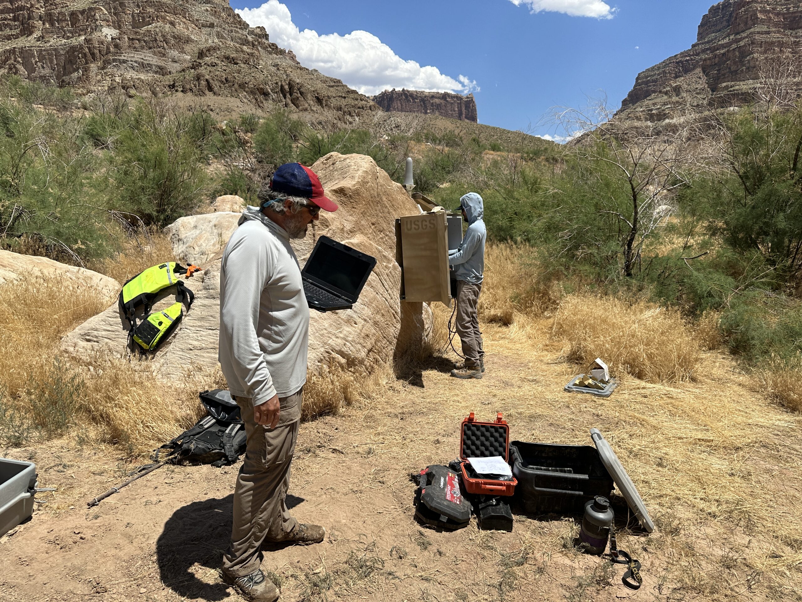
Returning Rapids plans a few trips every year: since last fall, they’ve scouted the San Juan River from Clay Hills to the confluence, pulled together past and recent observations concerning the Hite boat ramp, and worked with the USGS to install a new river flow gauge above the Gypsum Canyon rapid in lower Cataract Canyon: “a subtle nod from many Department of Interior agencies that there may never be a reservoir here again,” DeHoff said, “and there’s a need to monitor the river here.”

New river gauge
Where the new river gauge is installed used to be part of the reservoir: DeHoff said he’s heard stories and seen photos of people water skiing in the area, where now a rapid is returning as the water levels drop low enough.
Chris Wilkowske, a hydrologic technician with the USGS, said the gauge will be paid for by a national program called Next Generation Water Observing Systems—the program will pick a watershed to develop, then field project proposals. When the Colorado River Basin was chosen, Wilkowske pitched the Cataract Canyon gauge project. There are USGS gauges at Cisco and Potash, but after that, the next gauge appears downstream of Glen Canyon Recreation Area.
“There’s a big gap in gauges on the Colorado River,” Wilkowske said. “Everybody’s aware of the importance of tracking the water supply in the Colorado River Basin, but another factor is salinity: monitoring salinity in the Upper Colorado River Basin is a big deal—it’s cheaper and easier to keep salinity out of the river in the upper basin than to treat it through desalination in the lower basin.”
But it’s difficult to install gauges in that part of the river. It’s tricky to get to: the two options are to go through Cataract Canyon or travel up from Lake Powell. This summer’s high water provided a decent window in June for the second option—Gypsum rapid was flooded, allowing Wilkowske, with the help of the Returning Rapids team, to motor up and over it to access the gauge spot.
Wilkowske said the gauge should be operational, and showing river discharge, by this winter.
“There’s always been the need to have a water quality and water flow gauge below the confluence of the Green and Colorado Rivers,” DeHoff said. “It’s been something that people have been wanting to know for a long time.”
Looking forward
DeHoff said in the next few weeks, the Returning Rapids team will publish its annual field binder, a publication of all its recent work—the binder is aimed at the public, written in easy-to-understand terminology.
“We’re trying to get as many people aware of the issues as possible,” DeHoff said. “Because we really are heading toward making big choices about how we best manage the Colorado River, and I think right now, we’re not managing it as best we could.”
“People treat the sections that we study like terra incognito, especially on the San Juan. They’re like, ‘Well, no one goes there. So who is going to care about it?’” he said. “But we go down there. And we see this incredible wave of unmanaged natural restoration of the river’s ecosystem, and it is largely ignored. In a way, I think that’s really cool—it shows how much if left alone, the natural world is going to return to homeostasis.”


