Spanish Valley’s groundwater resources are out of sight, but they are not out of mind.
The U.S. Geological Survey (USGS) and the Utah Division of Water Resources are about one year into a detailed three- to four-year study that aims to provide local officials and residents with a clearer picture of the underlying Glen Canyon Aquifer.
Utah Division of Water Rights Southeastern Regional Engineer Marc Stilson told stakeholders last week that information about groundwater flows and appropriations can be used to formulate recommendations to the state engineer’s office. Those recommendations, in turn, will help the state engineer develop a groundwater management plan for the area.
“The USGS study is the first piece of the puzzle we need to give us a better understanding of what’s happening,” Stilson said during a June 16 meeting at the Moab City Center.
Researchers are focusing in part on the amount of water that seeps into the ground through rainfall and snowmelt, as well as the amount of water that leaves the aquifer through irrigation, culinary water withdrawals and naturally occurring seepage.
The study, which is funded through a combination of federal, state and local funding, was prompted in part by major applications for water rights in recent years.
In 2007, for instance, San Juan County applied for 5,000 acre-feet of water for future development in Spanish Valley. (One acre-foot of water equals about 325,851 gallons of water; the average home in Moab and Spanish Valley uses about 185,000 gallons of water per year.)
The state engineer’s office later issued a decision that granted San Juan County a portion of those water rights until it could better determine how much water is available in the aquifer, which is the valley’s sole source of culinary water.
According to Stilson, the Glen Canyon Aquifer is still open to small-scale appropriations of groundwater. However, most of the water in the valley is already controlled by public agencies, including the City of Moab and the Grand Water and Sewer Service Agency (GWSSA).
“They’re the ones that really have the water to develop, and they need to know how much more they can take out of the ground before we have to start looking at surface sources,” he said.
Stilson estimated that only 25 percent of the valley’s groundwater resources are currently in use, based on information from previous studies.
“So I don’t think we’re anywhere close to overdrafting the aquifer,” he said. “But it’s important for the public agencies to know what they can do looking forward … If it turns out that we don’t have as much water in the aquifer as we thought we did … then the public agencies need to know that.”
Assistant Moab City Engineer Eric Johanson has been reading or hearing about cases where that scenario is unfolding in California. Despite its reputation as an environmental leader, California has the dubious distinction of recently becoming the last Western state to enact regulations to protect its groundwater resources.
“It seems that one of their problems is that they overallocated with water,” Johanson said. “Now, it’s drier and they’re fighting over what little is left and lowering the groundwater table dangerously.”
Based on that state’s experiences, Johanson voiced concerns about what could happen if the Southwest’s climate grows drier over the long term, as some scientists have predicted.
Moab Mayor Dave Sakrison said that he and other local officials are mindful of the fact that they must not deplete – or “mine” – the valley’s groundwater resources at unsustainable levels.
“One thing that I think we’re acutely aware of (is) we don’t want to mine our aquifer,” the mayor said.
So far, preliminary USGS data do not suggest that the total measured discharge rate has experienced a massive decline in recent decades, according to USGS research hydrologist Vic Heilweil.
“It’s comforting that our numbers are not that different from 30 or 40 years ago,” he said.
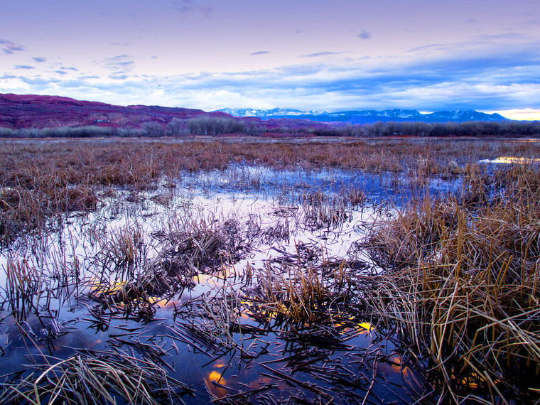
The Scott M. Matheson Wetlands Preserve is believed to be a major groundwater discharge point, and Heilweil outlined the steps that his agency’s researchers have undertaken there to date.
The agency has a budget to drill 10 or so pairs of wells in the area, but before it moves forward with that work, it partnered this spring with a smaller branch of the USGS to develop an overview that could guide those drilling efforts.
In the future, researchers are planning to drill bore holes at other sites around the valley to calibrate the actual groundwater recharge rate, albeit on a limited scale. One thing they’ll be scrutinizing is radioactive tritium, which acts as a tracer that helps researchers determine how long each sample of water has been in the ground.
“It’s by no means very comprehensive, but this is very expensive work,” he said.
Researchers working to better understand Glen Canyon Aquifer’s resources
I don’t think we’re anywhere close to overdrafting the aquifer, but it’s important for the public agencies to know what they can do looking forward … If it turns out that we don’t have as much water in the aquifer as we thought we did … then the public agencies need to know that.


