Some information may be outdated.
The Moab Museum is celebrating our last column focusing on water, in collaboration with the Utah Archives theme this month, with an extension of our column on Scenic Byway 128, known locally as River Road. (Read our last column from April 14th, 2022 at www.moabsunnews.com!)
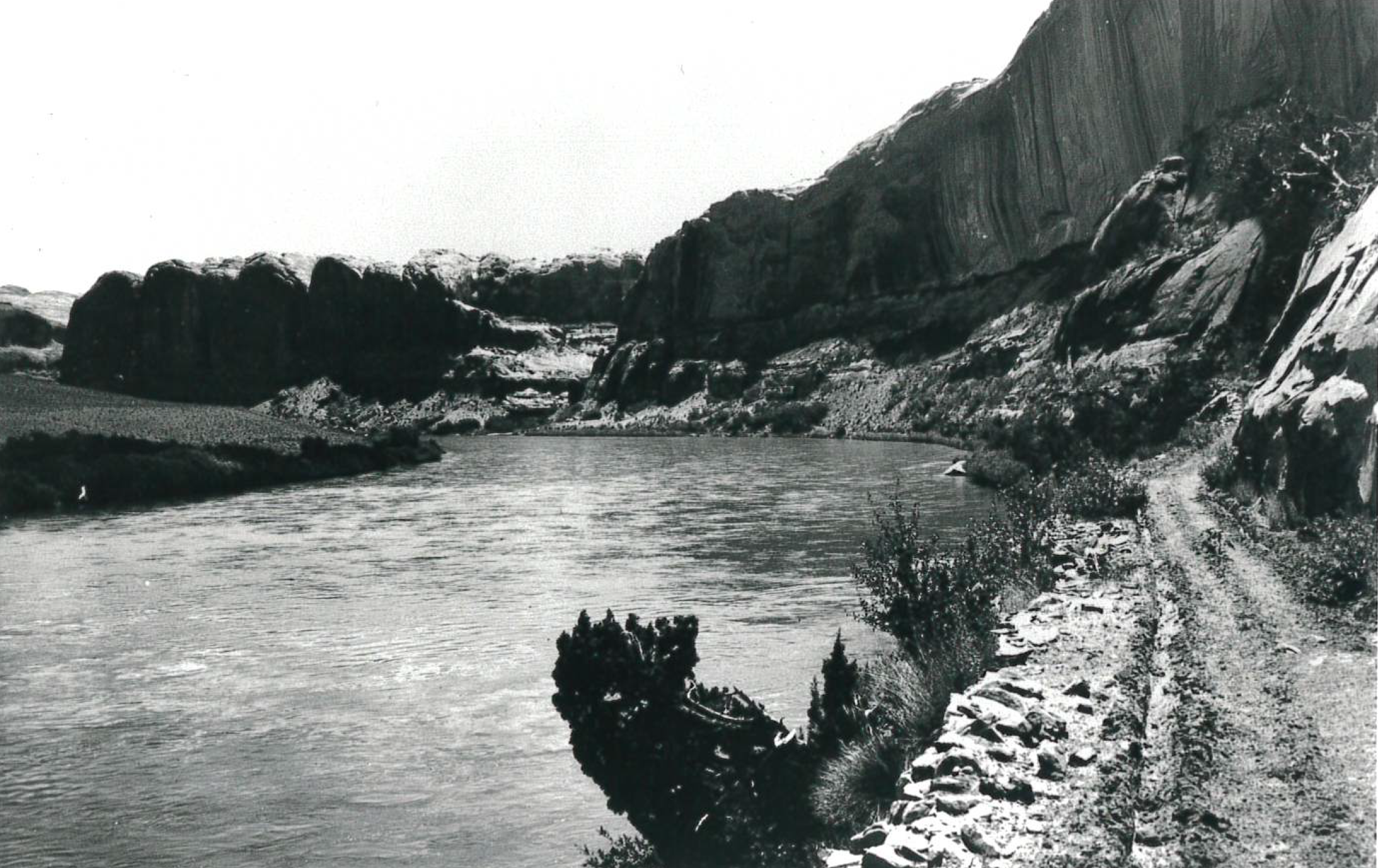
SR 128 has taken many forms over the years, from rudimentary singletrack primarily ridden by horses to a paved road. Now, 128 is also known as the Upper Colorado River Scenic Byway, and is part of the Dinosaur Diamond Prehistoric Highway. Travelers driving along the river are graced with views of Castle Valley, the Fisher Towers, and the old Dewey Bridge destroyed by fire in 2008, which was the longest suspension bridge in Utah until that date.
Throughout history, projects along the Colorado River, including the Bureau of Reclamation’s surveys for dam building in the area during the 1960s, threatened not only the connecting road between Moab, Castle Valley, and western Colorado, but the very existence of the community in the Moab Valley.
Photographs from the Moab Museum’s Collection tell the storied history of the River Road over time.


The Moab Museum is dedicated to sharing stories of the natural and human history of the Moab area. To explore more of Moab’s stories and artifacts, find out about upcoming programs, and become a Member, visit www.moabmuseum.org.
Appreciate the coverage? Help keep local news alive.
Chip in to support the Moab Sun News.


