Some information may be outdated.
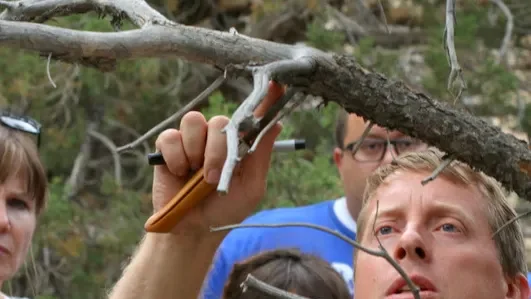
Science Moab joined Kara Dohrenwend, Director of Rim to Rim Restoration, along Pack Creek one summer morning to discuss creek science and restoration in the Moab area.

Dohrenwend: Rim to Rim Restoration started after seeing the [local] creek corridors full of [invasive plants] Russian olive and tamarisk back in the ’90s and realizing that it was a huge missed opportunity [to protect] an asset in the community. Moab is here because of the creeks, yet the creeks had been forgotten. The fabric of the community is the main interest in the creek projects that we do. Russian olive was brought in a long time ago by what was then called the Soil Conservation Service for erosion control purposes. Tamarisk moved in on its own.
Around 2004, Animal & Plant Health Inspection Service (APHIS), a USDA program, brought in a tamarisk leaf beetle. The State of Utah had all the weed supervisors across the state collect the tamarisk leaf beetle and distribute it throughout Utah. But there is no [such] biological control for Russian olive; it has a more extensive niche. It can grow right next to the creek, it can grow in an upland area that barely gets water, and it germinates in the shade—cottonwoods don’t [do that, and so can’t compete]. [These species] made it so that the creek corridors became a thicket you had to crawl through.
While there’s an ecological and wildlife benefit to removing the tamarisk and Russian olive…those species are pretty intensive ladder fuels [plants which allow wildfire to spread from the ground into the tree canopy]. They’re in the way of restoring the creek corridors—the ecological function, the hydrologic function, the flood flow function—but what actually appeals to human beings to remove them is that they can act like a wick [for wildfire].
Science Moab: A lot of the Russian olive was removed years ago. today, you’re out here replanting—what are you planting?
Dohrenwend: What’s happened at some sites, because they’re a little disconnected from the water table, [is that] the native plants don’t regenerate [without assistance]. So what we’re doing today is planting some cottonwoods, willows, and birch. We’re taking advantage of the shift in the creek to try to establish some native trees, because cottonwood and willow require wet soil to germinate. We’re giving them a head start by doing what’s called a long-stem planting: we’re digging and planting the [tree’s] root ball about four feet down so that the root ball should stay wet and never need to get watered again. Then, even if the creek moves back to its old channel, those native trees should still survive.
Science Moab: We’re standing here along Pack Creek, downstream from Cinema Court and behind Bonita Street, yet it feels very remote. What other stretches of Pack and/or Mill creek have you done this process in?
Dohrenwend: We’ve actually done more [work] along Mill Creek. Our first acre was at First West and First South near the Zax parking lot. We also did another acre behind the high school, just downstream of Fourth East in the late 90s. We’ve worked on 150–200 acres with about 80 landowners. Mill Creek [pathway] through town, a parkway everybody uses for transportation, was a thicket of Russian olive 25 years ago. It started out with the City putting in the pathway to help with some flood control issues, but it still was a tunnel [through a thicket]. So we’ve been working on Mill Creek through town [for years], and now we’re starting to work on Pack Creek. We have worked with Utah DNR Forestry Fire and State Lands and the Fire Department [on this project].
There are a number of properties up Pack Creek that we’ve worked on, and we learned from our work on Mill Creek… [to remove the invasive plants] intentionally in a patchwork method—and this is backed up by various studies about how to remove invasive species in a way that favors passive regeneration as much as possible of native plants. So, instead of starting at the headwaters and moving downstream or starting at the bottom and moving upstream, we do small patches, a few acres here and there, and then we give those a time to recover with native plants before we move on to the next.
Science Moab: Just a few days ago, [there were] a few floods in the area. How often do you go back to your patches and see how they fare through the flooding?
Dohrenwend: The last three years have been fascinating because we’ve had so many more extreme flows. When you look back at the historic record of flood flows through the valley, the last time we had a spate of roughly 5,000 CFS flows through this valley was in the ’60s, maybe. When you get a flow that big, it’s almost impossible to have a riparian corridor flood [buffer] big enough for it, especially as the town has grown. [Moab] being on [a landform called] an alluvial fan, what likely happened in the past when Mill Creek would flash like that is the flow probably spread out and sometimes—from what I’ve read through some of the old historic records about Moab—Mill Creek exited the valley where it is now down near Kane Creek Drive, but it would also exit the valley up by Grand Old Ranch House [Moab Springs Ranch]. The creek would move, which makes sense if you think about how an alluvial fan works [being prone to flooding and frequently changing direction of flow]. So that’s part of the challenge that we have, as a community built on an alluvial fan: the creek wants to move, it’s carrying sediment, it’s building up and cutting down. How do we manage that?
Appreciate the coverage? Help keep local news alive.
Chip in to support the Moab Sun News.