Some information may be outdated.
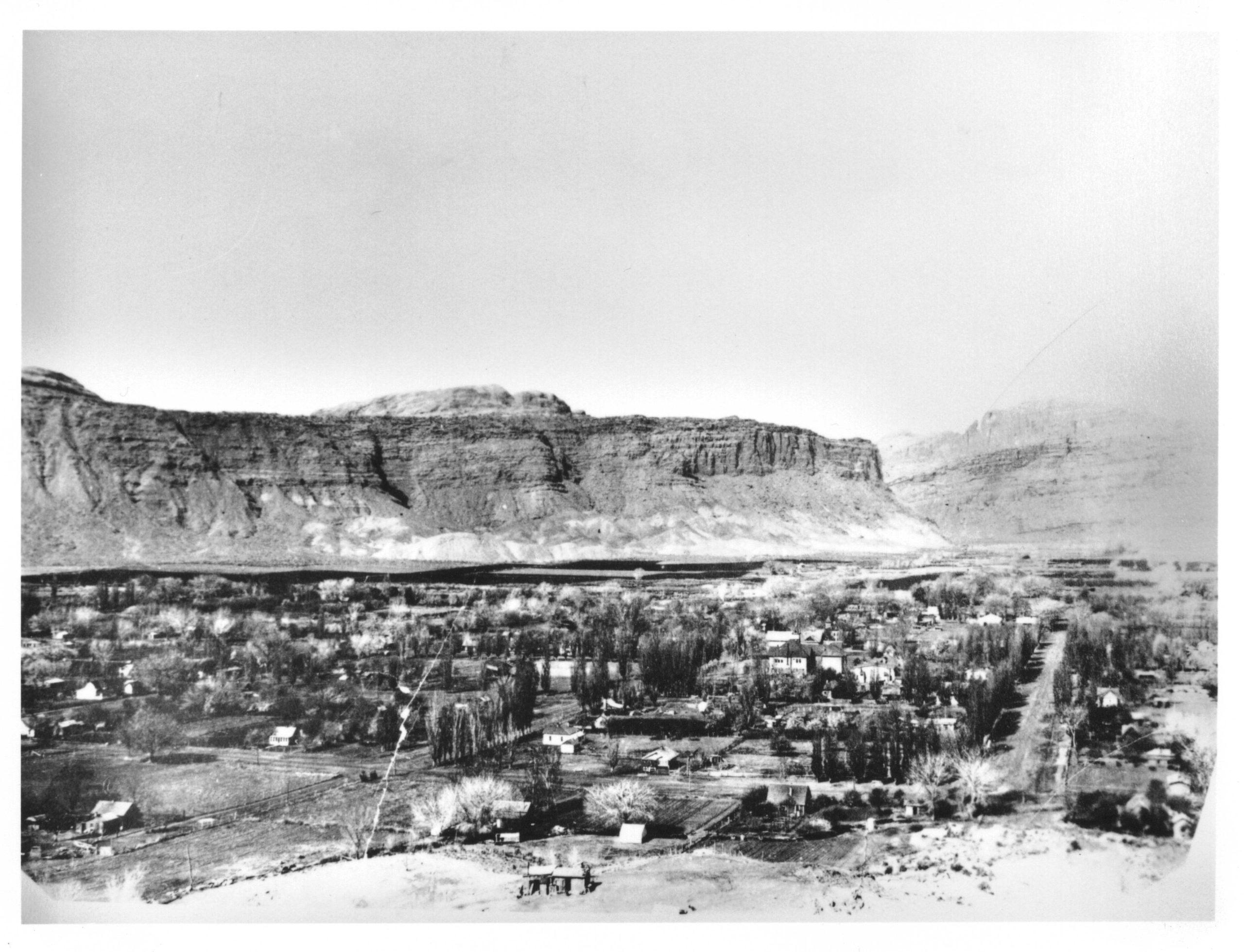
While photographs of people, storefronts, and downtown Moab offer a valuable view into the past, aerial images over the decades also help chronicle the large-scale changes Moab has experienced over the past century.
Numerous images in the Moab Museum’s collection offer a bird’s-eye view of the community over time. Some are taken from airplanes, others from cliffs surrounding town. Viewed together, these images show the changes in Moab over the decades as the community shifted from an agricultural economy to a mining boomtown and eventually to an outdoor recreation and tourism destination.


The Moab Museum is dedicated to sharing stories of the natural and human history of the Moab area. To explore more of Moab’s stories and artifacts, find out about upcoming programs, and become a Member, visit www.moabmuseum.org.
Appreciate the coverage? Help keep local news alive.
Chip in to support the Moab Sun News.


