Some information may be outdated.
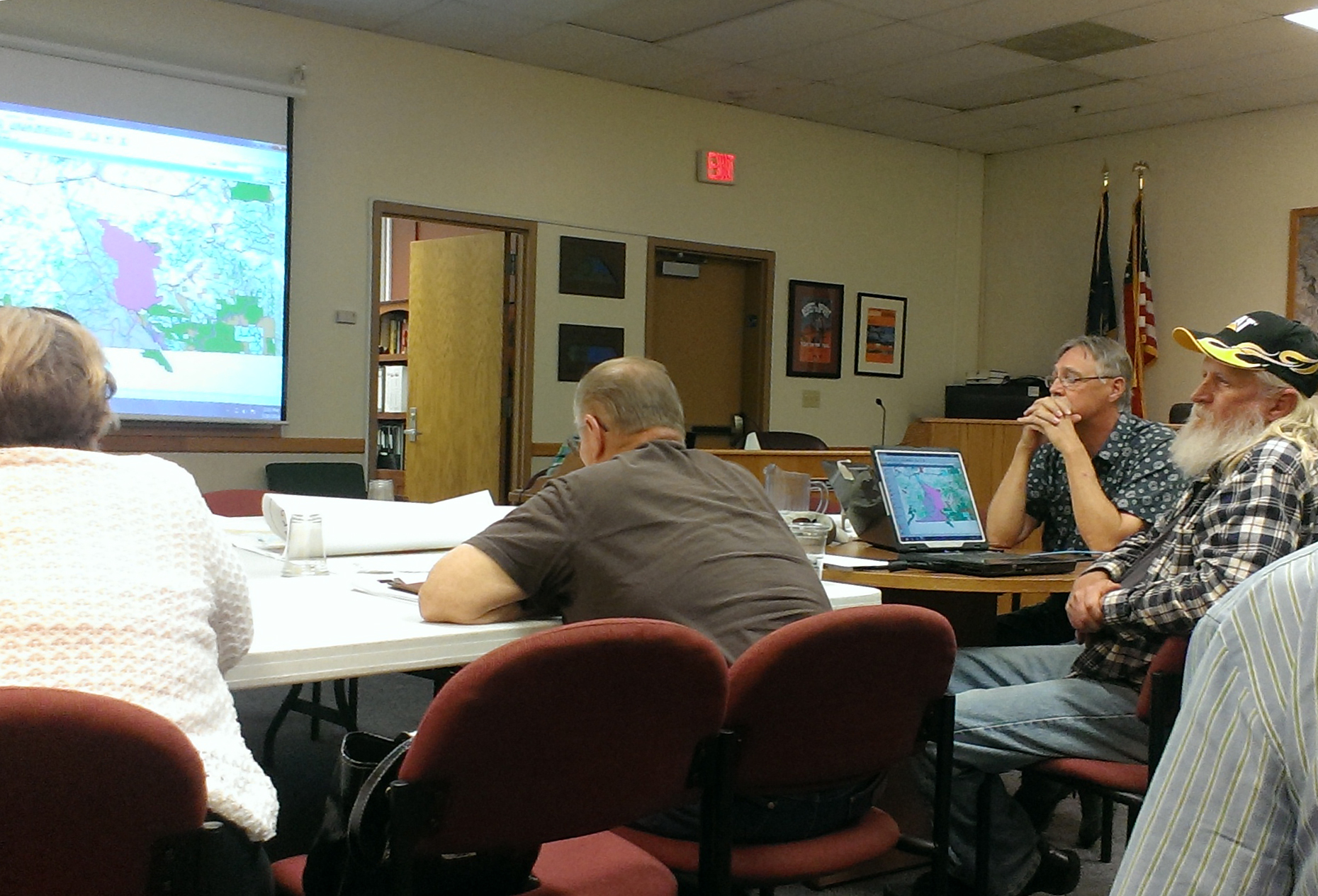
The Grand County Council met on Tuesday, June 10 in to discuss establishing recreation areas, water-protection proposals, and the Sego Canyon transportation corridor as part of Congressman Rob Bishop’s (R-Utah) public-lands proposal.
Council member Gene Ciarus opened the meeting with a recreation area proposal. The proposal, which was developed with the assistance of Public Lands Solutions members Ashley Korenblat and Jason Keith, showed areas in Grand County that would be designated as recreation areas for biking, climbing, horseback riding, and other non-motorized and motorized activities.
The designated areas include land around Gemini Bridges, Klondike Bluffs, Long Canyon, Amasa Back, Castle Rock, Ida Gulch, and Fisher Towers. The areas would be closed to oil and gas leasing. However, Ciarus did note it would honor current leases in the areas.
Council chairman Lynn Jackson questioned who would potentially manage the recreation areas. He suggested the county could potentially manage the area in a similar way to the Sand Flats Recreation Area.
“The key is revenue,” Jackson said. “We would have to establish some kind of booths. Personally, I hate that idea, and I am sick of having to pay for permits. But, that is what could come of the county managing this.”
Jackson also suggested other possible revenue sources to cover the management of the lands if the county decided to manage the area could include creating commercial user permits, similar to what the Bureau of Land Management (BLM) uses on its lands, or mineral royalty payments.
Ciarus said the proposal did not include a suggestion that Grand County manage the areas.
“It’s never been brought up in any of this that Grand County would manage this,” he said. “It would not be my thought that the county would manage these areas.”
Jackson said, whether it was the county or not, including in the proposal who would manage the recreation areas was important. Ciarus agreed and said the final proposal would include this information.
Council member Elizabeth Tubbs said the proposed recreation areas looked good, but work was still needed before a final proposal could be created.
“It’s a work in progress and it looks like some good alternatives,” she said.
The council then discussed the possibility of including a permanent designation of a plan called the Three Rivers Withdrawal into their proposal. The Three Rivers Withdrawal is a protective order that was signed in 2004 by then-Secretary of the Interior Gale Norton. The order included 192 miles of river corridor along the Green, Colorado, and Dolores Rivers. For 20 years, these areas are excluded from exploration or location of new mining claims. The council could vote to make these areas permanently closed.
Ciarus said that if restriction in the areas were limited to oil and gas, he was in favor of possibly including the withdrawal in the proposal.
Council member Pat Holyoak asked if the designation would affect businesses located in those areas and those who have water-use rights.
Jackson said water use would depend on how the areas of the river are designated and if there are minimum flow requirements for the area.
“One of the other things, with this (option) certain areas of the river were designated as wild and scenic,” he said. “They did an inventory and some parts are wild, some parts are scenic, and some parts are wild and scenic.”
Jackson said the different designations have different flow requirements, which could possibly affect water use in the areas.
The council decided to ask a BLM employee with more knowledge about the designations and water-use issues to attend the next workshop and explain more about the issues of continuing the Three Rivers Withdrawal.
The council moved on to the issue of the Sego Canyon transportation corridor. The council has agreed with Uintah County to conduct a feasibility study in Sego Canyon to see if a road could be placed into the Book Cliffs, creating a route between I-70 and a block of School and Institutional Trust Land Administration (SITLA) land. The approval of the feasibility study has been controversial, and Jackson said because of this, another corridor has been added to the study.
“Based on a whole lot of backlash on just the Sego Canyon corridor, we’re going to look at another corridor, Hay Canyon,” he said.
The council has been working with Uintah and Duchesne counties, the Utah Department of Transportation (UDOT) and SITLA to complete an economic analysis. The analysis is nearly ready to turn over to contractors, but the results from the study will not likely be ready before the council sends its proposal to Congress.
Jackson said the council would need to decide what to send to Congress in its proposal. He suggested the corridors be kept as placeholders from any type of action pending results from the economic analysis. The Council could also decide to propose including both corridors or only one.
Tubbs asked whether or not by including the corridors as placeholders in the proposal, the Council was voting to allow road.
“I have absolutely no hope that Sego Canyon can be designated as a feasible place to put a road,” she said. “If this is basically designed not to preclude some decision in the future, in the spirit of coming to some sort of middle on this, I can go along with that.”
Jackson said this could be defined in the proposal that no final decision regarding the road was being made. He also emphasized that Grand County would not be paying for the road.
“There is no way Grand County is ever even going to consider paving this,” he said.
Jaylyn Hawks, who is currently running for a position on the council, asked whether the results of the economic analysis can by trusted with outside entities paying for it.
“Information can be skewed toward those who are paying for it,” she said. “So this makes me a little nervous.”
Jackson said Grand County will be involved with the process to help prevent that from happening.
“We are going to be at the table,” he said. “We are going to help develop and drive this RFP so that we can have some comfort that we’re not getting skewed results,” he said.
The council also discussed possible watershed protection on Forest Service land from oil and gas leasing; how the Antiquities Act should be dealt with in the proposal; and if the council should include any information from the BLM about their leasing plan. Another workshop took place on Tuesday, June 17 to continue working on the proposal.
“I have absolutely no hope that Sego Canyon can be designated as a feasible place to put a road. If this is basically designed not to preclude some decision in the future, in the spirit of coming to some sort of middle on this, I can go along with that.”
Recreation areas, river corridors and a Book Cliffs road among items discussed
Appreciate the coverage? Help keep local news alive.
Chip in to support the Moab Sun News.


