Some information may be outdated.
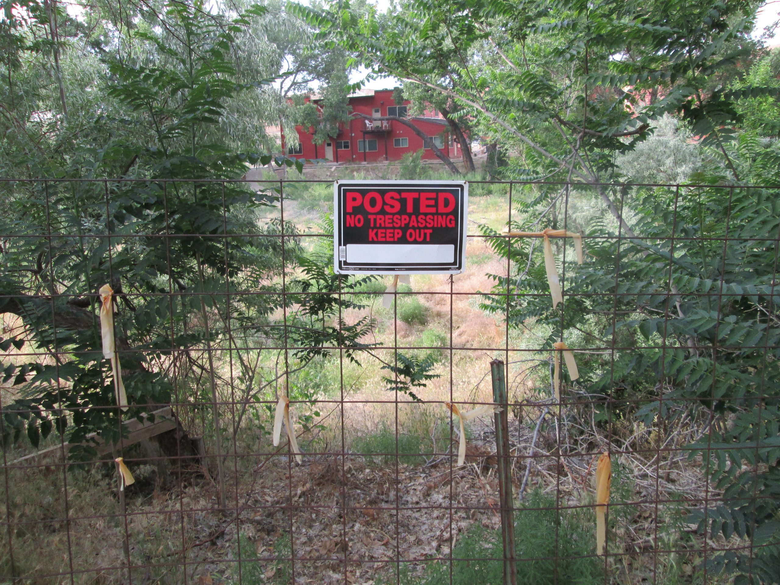
After two-and-a-half years of confusion, a fence blocking the bike path connecting the Grand-Vu Subdivision to Mill Creek Drive at the north end of San Miguel Street will be removed and the path re-established.
“I’d like to see everything up and running before school starts again after summer because I think there are kids in that neighborhood that would use that trail to ride their bikes to school,” Grand County Council chairman Lynn Jackson said.
Moab resident Rebecca Andrus brought the issue to the Grand County Council on Tuesday, June 3.
“Considering that the presence of this fence is on public property, is not doing anyone any good and the removal of the fence would be a benefit to the citizens of Grand County, I would like to petition the County Council to direct staff to move forward with the necessary steps to remove the fence, re-establish the trail, and allow the planned-and-paid-for path to be used by the community,” Andrus said.
The fence blocking the path was erected in 2011 by private property owners who believed at the time that they owned the roughly 60-foot wide swath of land at the north end of the San Miguel Street cul-de-sac. A sign on the fence reads “Private Property, No Trespassing.”
“The true disposition of the property has not been made public,” Andrus said.
As a result, bikers and pedestrians have been thrown off course by the fence, frequently crossing over what is indeed private property to get around the obstacle.
The trail, completed in 2010, was part of a larger, $322,000 project that included a the resurfacing of Mill Creek Drive from Sand Flats Road to Pack Creek bridge, bike lanes on Mill Creek Drive, a concrete path and associated easement from Mill Creek Drive, behind what is now the Cinema Courts Apartments, to Pack Creek, a bridge crossing Pack Creek and a wood-chip path through the Pack Creek flood plain to San Miguel Street.
“That bridge and path there at San Miguel were a crucial part of [the project],” said Andrus, who is also the Moab city engineer. “One part of the history that emphasizes how important that part [of the trail] is, was when the Pack Creek road bridge was down.”
When the bridge was being rebuilt in 2011, all northbound traffic had to detour south to U.S. Highway 191. Bike and pedestrian traffic had the option of taking the bike path and consequently, traffic on the path increased.
Andrus said the increase in traffic concerned the property owners near the San Miguel Street trailhead. The city and county agreed to help mitigate privacy issues and commissioned a survey to determine where fencing or hedging could be placed on their private property.
The long-time landowner abutting the easement on the east side believed he owned and paid taxes on that waste land, though it was never in a legal description of his property, nor did he actually pay taxes on it, Andrus said.
The landowner abutting the easement on the west side actually has paid taxes on the bit of county property on his side due to an erroneous legal description that integrated the patch of dirt into his lot.
The surveyor, in his report, said that the landowners deserved to take possession of the waste property.
“(The landowner), one of the first residents/buyers in Grand-Vu Subdivision and still there today, adamantly states that the waste areas are part of the lots adjacent,” the survey report said. “Though biased, this oral evidence is the only oral evidence available, but it does support this surveyor’s determination.”
The county and real estate attorneys who reviewed the survey, came to a different conclusion, primarily based on the fact that the county owns a piece of property in the flood plain just north of the “waste” property.
The original plat, which was not referenced in the surveyor’s report, showed the cul-de-sac in a slightly different location than where it physically sits. In that plat, the cul-de-sac abuts both the street and two northern lots. Amendments to the plat shifted the cul-de-sac over and down to match its physical location, consequently leaving a 60-foot wide space of varying depth between the end of the pavement and the boundary of the northern lots, labeled on the plat amendments as “waste.”
“The county attained that piece of property through a tax sale—somebody didn’t pay their taxes back in the day,” County Attorney Andrew Fitzgerald said. “Basically, Utah courts won’t allow a piece of property to go to waste because there’s no access to it. On top of that, there’s an easement, a very large easement, that allows the county to get back to that property.”
Despite the attorney’s conclusion, the trail remained blocked.
“I think for the last few years we’ve tried to handle [the property owners’] concerns in a more gentle fashion instead of just coming in and saying ‘well, we’re the government, this is what we’re going to do,’” Jackson said. “We thought, ‘let’s try to work with them a little bit.’”
“We (Trail Mix, Grand County, City of Moab and others) have evaluated the alternatives and San Miguel is the logical choice,” said Chris Baird, who was a council member in 2011 and is also a member of the Trail Mix committee. “All choices involve folks who don’t want their privacy affected, but the San Miguel route involves the least construction effort and property clearance.”
Jackson has said the county is willing to work with the property owners on fencing and landscaping to mitigate privacy concerns.
Drew Roots, one of the adjacent property owners, said that he has been notified the fence will be coming down, but has never received any information explaining why the surveyor’s conclusion might be erroneous.
“We’d like to see that information so that we understand how the attorney’s came to their conclusions,” he said.
“I think for the last few years we’ve tried to handle [the property owners’] concerns in a more gentle fashion instead of just coming in and saying ‘well, we’re the government, this is what we’re going to do.’ We thought, ‘let’s try to work with them a little bit.’”
County says landowner put fence up believing he owned “waste” property
Appreciate the coverage? Help keep local news alive.
Chip in to support the Moab Sun News.


