Some information may be outdated.
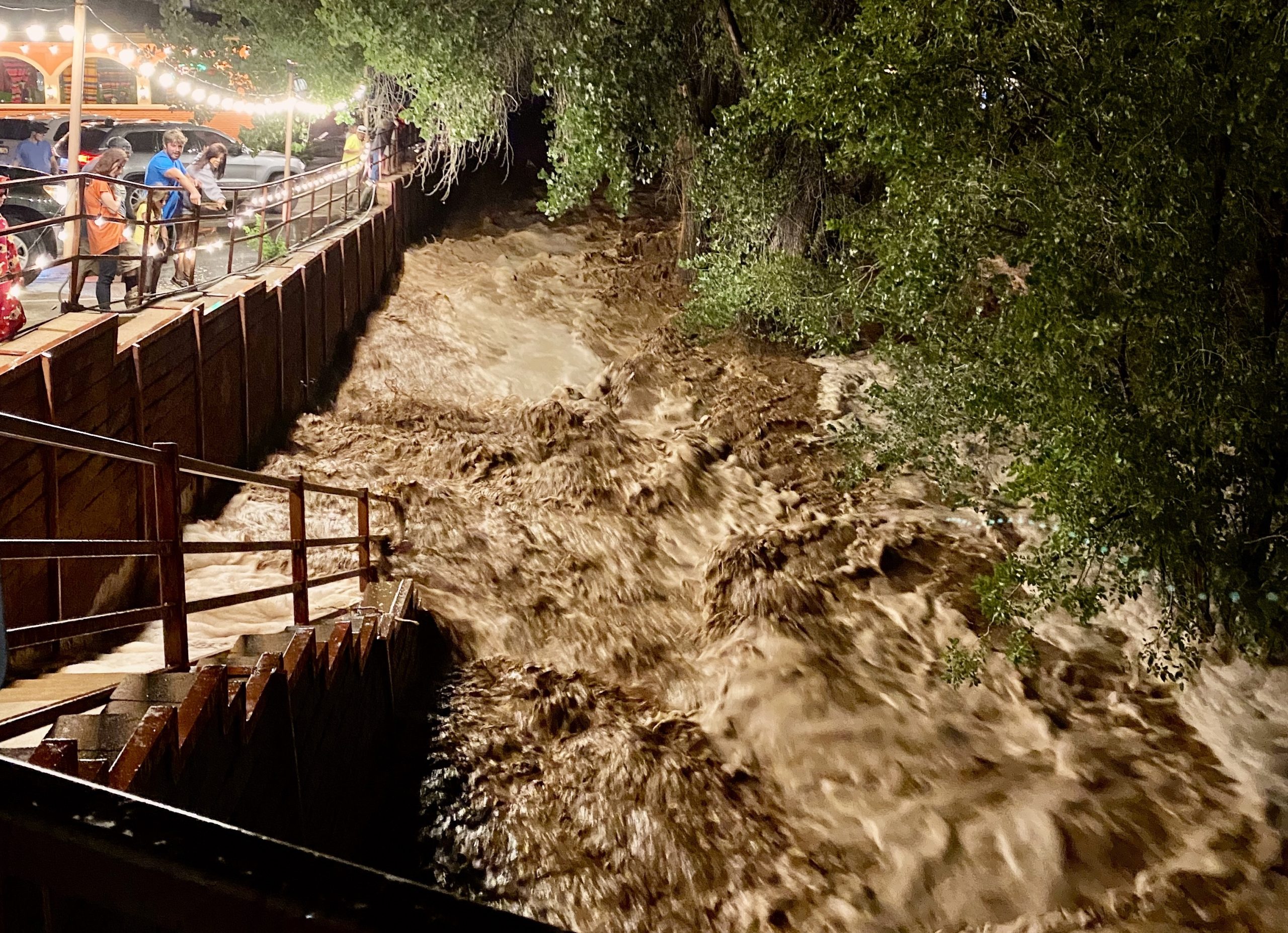
Experts are deeming Moab’s Aug. 20 flash flood as a “100-year” flood—but almost exactly one year ago, Moab dealt with another 100-year flood. The Aug. 20 flood was notable for more reasons: it marks the third time Mill Creek has flooded this year; it broke new records for water height and cubic feet per second that were just recently set during a flood on Aug. 11; and marks the only time the City of Moab has ever declared a state of emergency due to flood damage. City staff are reminding residents, and visitors, to stay vigilant: monsoon season isn’t over yet.
The Moab Sun News chatted with Jon Meyer, a climate researcher at the Utah Climate Center whose expertise is in regional climate modeling and the North American monsoon, about how this year’s extreme monsoon season impacts the larger climate and what to expect in the years ahead.
“It’s an amazing weather phenomenon,” Meyer said. “The monsoon season is the hardest to predict just due to its variability and localized rainfall, so it’s certainly a challenge to anticipate what any given year could look like.”
MSN: What is the impact of short-term, extreme events on the long run of Utah’s drought?
Meyer: The monsoon really isn’t sufficient in its ability to give us water to the degree that we get during the wintertime. So an amazing monsoon season like we have had the last two years is really good at kicking the can down the road, and not exacerbating the drought. The summer months are when we can get into really big trouble really quickly with drought if we don’t get the monsoon season.
Monsoons provide soil moisture. During the warm season, the evaporative demand from low humidity, high temperatures, and sunlight can really dry our soils out. So when we get a good monsoon season, the soil moisture stays elevated. When we preserve that high soil moisture into the fall, that can set the stage for really good subsequent spring runoff—any snow that is built up on top of frozen soil has a chance to runoff into rivers and reservoirs, as opposed to just getting soaked back up into the soil.
MSN: How are flood rankings—like 50-year and 100-year—determined?
Meyer: It’s incredibly confusing terminology. We calculate these numbers by collecting all of our historical observations of precipitation for an area—sometimes it’s 30 years, sometimes it’s 130 years, depending on where we’re at. We put all of those observations together to come up with a statistical distribution—think of a bell curve in school grades, where you get a distribution of many As and two Fs. Precipitation isn’t exactly a bell curve, but from the shape of that distribution, we can look at the extremes on either end and get a statistical idea of how probable those events are over a given period of time.
There are a couple of oddities that make this confusing. The idea that a flood is a “100-year event” seems to mean that you only could get one of those every 100 years. But the reality is complicated, just because of the physical world. You could have back-to-back 100-year events inside of one season and then never see another one of those precipitation events again.
But we’re noticing extreme precipitation events get more extreme. Over the next 100 years, what will qualify as a 100-year event will look very different than it does now.
MSN: When would you recalibrate those terms?
Meyer: One way that we try to assess those upper limits is through something called “probable maximum precipitation,” which tries to project the maximum precipitation an area could receive over a given timeframe, like three hours, 24 hours, or 72 hours. The state will contract with climate centers or private consulting firms to quantify these maximum precipitation estimates, and they do those updates every 20 years or so.
We just updated Utah’s last year. What we found is that based on the 1980s update, the 1990s update, and our recent 2020 update is that those upper thresholds are getting higher and higher every time we update them.
We took it a step further and went into research mode: Instead of looking at historical observations, we looked forward in time using climate projections. We found that with climate change and global warming, the ability of the atmosphere to hold moisture increases at an exponential rate the warmer you get. This fits the theory that we’ve been talking about as a climate science community for several decades.
When you get warmer temperatures, you get higher humidities, which lead to more heavy precipitation events, and more extreme precipitation. We’ve already seen that occurring since the early 80s.
When we look forward in time, the trend of increasing precipitation and extreme events continue to play out more and more aggressively through the rest of the century.
MSN: I think the most interesting part of monsoon season is that we are always so grateful for rain, especially in a drought, but at the same time, we don’t have the infrastructure to support extreme events. It’s such a double-edged sword.
Meyer: Definitely. The state commissions these “upper limit” updates because they use those maximum thresholds to determine infrastructure guidelines: how much does a dam need to build up, or how much does the city’s sewer system have to be able to handle? The most concerning thing that we came to a conclusion on was not the climate change impact, but the fact that all of our infrastructure is based on what we now consider fairly outdated upper thresholds of precipitation.
The concern with the ongoing trend of extreme precipitation is the potential for infrastructure failure on the dam and reservoir levels—an inability to handle the amount of precipitation and runoff that we could see now with the flooding events, but even more so coming down the road.
The state is over-engineering, to a degree. But if those over-engineering thresholds are based on past observations that we know are changing and getting more extreme, we have to also account for the change in that for future scenarios.
That’s part of the work that we’re going to be doing over the next year or two: we’re trying to understand how to quantify all of these changing extremes of precipitation, and how those relate to infrastructure planning.
MSN: Have you observed larger monsoon events across the state or country?
Meyer: We are seeing more and more frequent monsoon moisture making it into areas that 50 years ago, weren’t seeing that kind of event occurring—or it was occurring much less frequently. We’re talking about monsoonal moisture making it up into Idaho and Montana sometimes.
The monsoon system, when we’re looking at the continental scale monsoon circulation pattern, is very different than it was 50 to 100 years ago. We believe with a pretty high degree of confidence that the reason for that is this idea that global climate change is adjusting atmospheric circulation to humidity in the air.
The overall season is impacted too: it’s arriving earlier and lasting later.
This interview has been edited for length and clarity.
Appreciate the coverage? Help keep local news alive.
Chip in to support the Moab Sun News.


