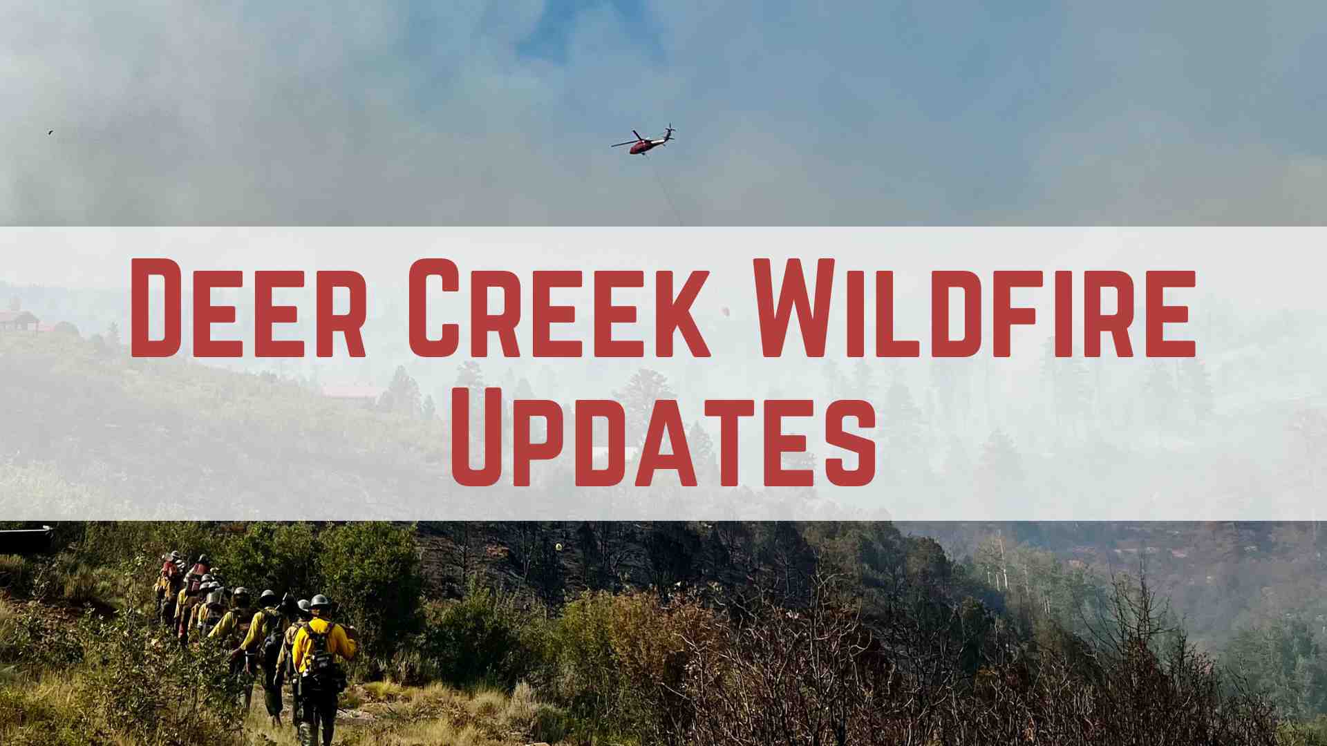
Firefighters make major progress with favorable weather; some Grand County impacts easing as evacuated residents return
Firefighters battling the Deer Creek Fire southeast of Moab achieved a major breakthrough Friday, increasing containment from 11% to 17% as rain and cooler temperatures provided the most favorable conditions since the blaze began nine days ago.
The fire has burned 15,892 acres across Utah and Colorado but crews made significant progress along multiple fronts, according to Great Basin Complex Incident Management Team #4.
Deer Creek wildfire, which started near La Sal, now has 524 personnel deployed including 6 helicopters, 34 engines, 12 crews, and 5 dozers. Rain fell on the west and southeast sides of the fire, creating more humid conditions that slowed fire progression and allowed crews to secure smaller spot fires near the southeastern edge above Paradox Valley.
Current firefighting operations
Crews continued working along the western fireline where they increased containment, while also securing smaller spot fires. Air operations include drone-delivered ignitions to set controlled fires ahead of the main blaze to remove vegetation and slow the fire’s advance.
Firefighters are focusing on structure protection around Canopy Springs and Peaceful Valley Ranch residences. The rugged terrain and lack of road access have made it difficult for ground crews to reach the north and east portions of the fire perimeter.
Air quality and Grand County impacts
Current air quality readings for Moab show “Unhealthy for Sensitive Groups” conditions due to smoke drift from the fire. The Air Quality Index reading of 106 means residents should limit outdoor activities, especially children and those with respiratory conditions.
Smoke conditions varied throughout Saturday, with some relief in Paradox Valley before afternoon showers pushed smoke down cliffs and into the valley. For current air quality updates, fire officials recommend checking AirNow.gov before planning outdoor activities.
The Old Spanish Trail Arena is currently closed to public access as it serves as the fire incident command post. However, outdoor arenas remain open for reserved training and activities, and stalls are available for evacuees with livestock.
La Sal area evacuations and returns
Some residents previously evacuated from areas around La Sal are returning to their homes after fire officials determined conditions were safe. However, evacuation orders remain in place for San Juan County residents north of Highway 46, between Upper 2 Mile Road and the Utah-Colorado state line. Those in “Set” status should be prepared for potential evacuation orders should fire activity increase.
The fire has crossed into Colorado, burning approximately two miles north of State Highway 90 in Montrose County, where the sheriff’s office issued pre-evacuation notices to residents near the fire.
Road closures and travel impacts
Highway 46/90 corridor near the Utah-Colorado border continues experiencing heavy fire traffic with possible low visibility conditions. County roads within the San Juan County evacuation area remain closed to public traffic.
The Bureau of Land Management issued a Temporary Emergency Closure affecting roads on BLM-administered public lands in the Paradox area in Montrose County, Colorado. The public should avoid the old airport landing strip in Spanish Valley to allow helicopters and crews to operate safely.
How Grand County residents can help
Local residents looking to support firefighting efforts and displaced families can help in several ways. Financial contributions can be made at Desert Rivers Credit Union under “Moab Valley Fire Donation Account” or at Station 1 (45 South 100 East).
Non-perishable donations including electrolyte drinks, hygiene items, and snacks are accepted at Station 1. For residents wanting to help displaced families, San Juan County recommends donations to the Red Cross.
Evacuees from the La Sal area can find emergency shelter and information at the La Sal Community Center on Highway 46 in La Sal (approximately 25 miles southeast of Moab).
Regional fire season context
The 2025 fire season has been particularly challenging across the Southwest. Utah alone has recorded 563 wildfires burning over 77,500 acres through mid-July, reflecting broader regional trends as parts of the Southwest now experience approximately one month more fire weather days than 50 years ago.
Currently, 88 large wildfires are burning nationally, requiring over 17,000 firefighters and support personnel.
Emergency information and alerts
Residents should sign up for emergency alerts through:
- San Juan County, Utah: sanjuancountyut.gov/emergency-management/page/san-juan-alerts
- Montrose County, Colorado: montrosecountysheriffsoffice.com/montrose-alerts
Updated information is available at inciweb.wildfire.gov/incident-information/utmlf-deer-creek and facebook.com/UtahWildfire.
Fire conditions change rapidly. Residents should monitor official sources for the most current information.
Appreciate the coverage? Help keep local news alive.
Chip in to support the Moab Sun News.