Some information may be outdated.
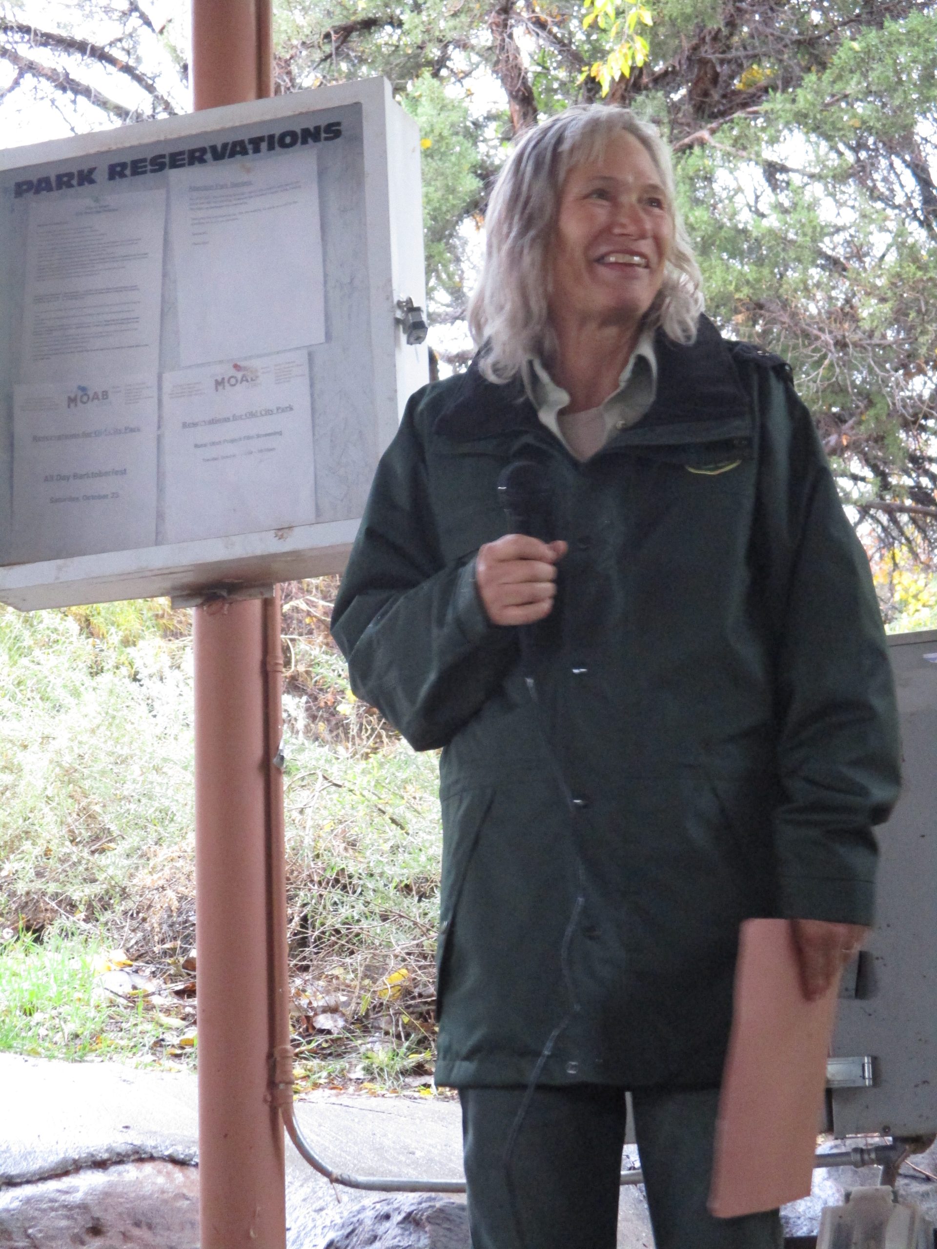
In spite of Tuesday’s dreary weather, about 45 people attended an open workshop hosted on Oct. 26 by the Utah State University Moab Extension to talk about recovery efforts for the area burned by the Pack Creek fire this summer.
The Pack Creek fire was started by an abandoned campfire in the Pack Creek Picnic Area on June 9, on a day with high winds, high temperatures, and dry fuels. It quickly spread through the Pack Creek subdivision and burned up the hillsides into the La Sal Mountains. The fire was contained on July 2, after burning 8,952 acres and destroying 10 structures in the Pack Creek neighborhood. [See “Pack Creek Fire is 100% contained,” July 8 edition. -ed.]
Later in the summer, Pack Creek itself surged in a flash flood with charred debris and ash-black water after a heavy rain event high in the drainage. Experts noted that water can run quickly off of burn scars because there is little or no vegetation to slow it down, and because the soil becomes “hydrophobic,” or water-repellent, when heat from a fire disperses waxy compounds from leaves and plant litter and those compounds coat soil particles. [See “Flash flood in Pack Creek,” July 26 edition. -ed.]
At the Oct. 26 workshop, experts from the US Forest Service, the Bureau of Land Management, the US Geological Survey, the Moab Valley Fire Department, the Utah Division of Forestry, Fire and State Lands, and USU discussed the fire recovery process, including the cycle of grief for values lost, ways the community can grow, monitoring of regeneration in the burn scar, and physical restoration actions that are being planned now or may be implemented in the future.
Community grief
Much of the La Sal Mountains were closed for weeks over the summer, and community members worried about how the fire would affect the forest long-term. Local artists made La Sal Mountain shirts as a fundraiser to support recovery efforts; local bookstore Back of Beyond Books hosted a community gathering for people to share their grief.
Courtney Flint, USU Extension professor of sociology, opened the Oct. 26 workshop with a discussion about how loss caused by a wildfire can trigger cycles of grief in communities and individuals. Last year, Flint conducted a “wellbeing study” in Moab to gauge what Moab area residents value and how content they are with their lives and community. The study showed that “connection with nature” was one of the top three “domains of wellbeing” for respondents, and over 80% of survey respondents said that local environmental quality and connection with nature are “very important” to overall well being. It’s no surprise, Flint said, that the Moab community was deeply affected by the Pack Creek Fire.
She described how people may experience the classic phases of grief identified by Swiss psychiatrist Elisabeth Kubler-Ross: denial, anger, bargaining, depression and acceptance. Those stages may be experienced in different orders, and may resurge. However, Flint noted that people who are more engaged with recovery, and people who have a stronger connection to nature, are more likely to arrive at a positive outlook on a wildfire, as they observe the regeneration over time.
A Pack Creek subdivision landowner in attendance at the workshop said he had observed some positive effects from the fire: before the area burned, he said, many of the pinyon and cottonwood trees in the area were dying. He’s observed that those species are recovering faster post-fire, offering him the kind of positive perspective Flint described.
Burned Area Emergency Response
US Forest Service Hydrologist Daniel Lay outlined three phases of landscape recovery after a wildfire. The first, he said, is rehabilitation of lines cut through brush and trees by fire crews or bulldozers during fire suppression. Next, a burned area emergency response, or “BAER,” team of experts begin assessing damage and evaluating potential restoration actions before the fire is even fully contained. Experts on the BAER team may include soil scientists, hydrologists, botanists, archaeologists, biologists, and other scientists. The team assesses threats to human life and safety, and determines critical values that exist in the burned area. Lay emphasized that the team’s job is “emergency response,” not “emergency rehabilitation” or “restoration”: the team’s job is initial response, not long-term recovery action.
The BAER team created a soil burn severity map of the Pack Creek burn scar. Satellite imagery helps experts estimate burn severity by looking at whether leaf litter and organic matter is left behind, the color of ash, and how much of the tree canopy has been consumed. Experts check their maps in the field.
Combining information about how severely areas were burned and what critical values may be at high risk, land managers then make determinations about what restoration actions to take. If burning is not severe enough, or no critical values are at a high enough risk, the Forest Service can’t justify large restoration projects.
The Forest Service also works with other agencies, such as the Natural Resources Conservation Service, to identify post-fire threats. Some treatments for rehabilitation have been approved and implementation has begun. For example, parts of La Sal Pass Road have been closed and there are plans to install rip rap to stabilize it. There is also a procedure to detect and remove noxious weeds that arrived in the La Sals due to fire suppression efforts, and a procedure for teams to respond to debris flows that occur from flooding in the fire area.
Forest Service Wildlife Biologist Barb Smith (who also has expertise in botany) discussed a native reseeding project that will take place in November. This project will have three phases, including aerial reseeding of areas that have been “chained” in the past (chaining is a technique that reduces heavy fuels, used to create fire breaks or sometimes to manage habitat.) Also this fall, some areas will be reseeded by hand, both on slopes and in drainages. Species in the native seed mixes will include basin wildrye, indian rice grass, streambank wheatgrass, and bitterbrush.
The third phase of recovery that Lay described is “long-term,” meaning three to five years after the fire. Actions might include stream channel treatments to raise incised drainages, possibly using “beaver dam analogs,” which cause sediment to build up over time, raising the profile of the stream channel. Road improvements might also be more effective after more time has passed and vegetation has had a chance to recover and naturally restabilize slopes that are currently repeatedly washing out and obstructing roads.
In response to a question from the audience, Lay noted that usually, burned areas are “rested” from grazing activities for three years after the fire, but he added that units will be reviewed on a case by case basis.
Dr. Michala Phillips is a soil ecologist for the USGS. She spoke about post-fire research she’s conducting in Mesa Verde National Park, near Cortez, Colorado. Most of that park has been burned, with many fires having occurred in the early 2000s, Phillips said. About 15-20 years after those fires, Phillips is comparing how pinyon/juniper plant communities recover after fire, after thinning treatments, or when they’re undisturbed. She’s found that in burned areas, recovery of pinyon/juniper is very slow. She also noted that Mesa Verde lies in the hottest, driest part of the pinyon/juniper plant community’s range, and that climate change further heating and drying the region could be contributing to lack of recovery for those plant communities.
Managers of the Pack Creek Fire area can also look to long-term recovery efforts on the Seeley Fire, which burned about 45,000 acres in Carbon and Emery counties in 2012. Agencies including the Utah Division of Wildlife Resources and the Utah Watershed Restoration Initiative continue to take rehabilitation actions in the Seeley Fire burn scar.
“Although it can often take decades for affected lands and water bodies to fully recover on their own, active hands-on management can often speed up and improve the recovery,” according to an Oct. 19 DWR press release. Agencies reseeded the Seeley Fire burn scar in 2012, but limited funding meant they had to prioritize which areas received treatments. Rainstorms after the fire caused debris flows and erosion, sending lots of sediment into nearby rivers, harming fish.
The DWR partnered with other agencies to install analog beaver dams in Miller Creek in 2016, which were effective in speeding stream recovery. Other actions taken on the Seeley Fire include rebuilding stream channels using heavy equipment. More restoration actions are planned in that area for the coming year.
“Typically, intensive stream restoration efforts don’t begin until roughly four years after a wildfire, in order to give the slopes time to stabilize and to see if some areas will naturally recover without utilizing additional tools and techniques,” says the DWR press release.
“Sometimes, you have to allow restoration projects time to regenerate or stabilize for a few years to know if you need to continue those efforts,” DWR Wildlife Impact Analysis Coordinator Nicole Nielson said in the statement. “When active restoration efforts are underway, staying out of these areas is very important, in order to reduce erosion and to not disturb new vegetation or other stabilization efforts.”
Wildland Urban Interface
Several speakers at the workshop discussed the “Wildland Urban Interface,” or WUI, and how that type of fire changes firefighting tactics, as well as ways communities can prepare for WUI fires. WUI is where developed areas abut wildland areas and have the potential to spread fire between infrastructure and natural fuels.
Ryan Burraston, administrative assistant and firefighter with the Moab Valley Fire Department, described how structure fires and wildland fires call for different tactics and strategies. With structure fires, he said, there are often greater values at stake, possibly including human lives and homes. These values necesitate a more aggressive approach to fire suppression. Structure firefighters are also used to having unlimited access to water; he noted that on the first night of the Pack Creek Fire, crews used 30,000 gallons of water and drained a local water storage tank. Wildland firefighters usually have less access to water and less critical values at stake, and may use more defensive strategies to corral and contain fire.
Burraston emphasized that a big reason firefighters were able to save most of the structures in the Pack Creek subdivision was how much work property owners had done to keep their buildings clear of fuel, as well as the fact that most buildings in the area were made of less-flammable materials, like stucco.
“It was pretty incredible to see what some of the homeowners had done out there,” Burraston said, noting that moderate preparations like keeping the ground clear of flammable materials, spacing out trees, and keeping flammable materials like wood piles away from homes may have made the difference in saving structures. A home sprinkler system can also help firefighters pre-soak a property ahead of an approaching fire to help keep it from burning.
Pack Creek residents in attendance stood to applaud the work of firefighters after Burraston spoke.
Jason Kirks, a BLM firefighter who took command of the Pack Creek Fire on the first night, agreed that small steps taken by homeowners made a big difference in keeping firefighters safe and allowing them to engage the fire as it moved through the neighborhood. He also noted that fuel treatments conducted by land management agencies, including the BLM and the FFSL, in public lands neighboring Pack Creek homes also helped reduce the intensity of the fire.
Kara Dohrenwend is the director of local nonprofit Rim to Rim Restoration, which focuses on watershed restoration. She has worked with local landowners on projects to remove invasive species and reduce fuels along creeks. Dohrenwend and others noted that the WUI can exist even in town. Residents near brushy creek beds, even if they live in town, are in an area where natural fuels and infrastructure can spread fire to each other. The Cinema Court Fire, which burned along Pack Creek near Spanish Valley Drive and Mill Creek Road in 2018, demonstrated this.
Dohrenwend and other speakers noted that it can be difficult to convince property owners to clear their properties for a variety of reasons. Some people don’t have the time or resources to attend to it; others treasure certain trees that may be dangerously close to their homes; others enjoy the sense of privacy they feel from thick brush edging their property. Dohrenwend noted there are many benefits to clearing property, aside from fire safety. It can provide access to creeks, improve views, and allow native species to thrive. Rim to Rim continues to work with property owners and other nonprofits to conduct fuel reduction projects, while also carrying out the organization’s mission of stream restoration.
Meanwhile, Rim to Rim is also in discussion with Pack Creek landowners and other agencies regarding restoration planning for the burned areas. Dohrenwend pointed out that a lot of the most effective restoration occurs naturally.
“The single most important thing to do right now is to wait,” she said. “Waiting time is often when the real magic happens.” After observing how the burned area is beginning to recover itself, people can then see the most effective ways they can speed that recovery with projects.
After a session at Old City Park, workshop attendees traveled to the point of origin of the fire, at the Pack Creek Picnic Area, and heard more from firefighters on initial and extended attack, as well as accounts from Pack Creek property owners. Ongoing discussions, monitoring, restoration and preparation will help the Moab community better understand fire behavior, effects, prevention and recovery.
Appreciate the coverage? Help keep local news alive.
Chip in to support the Moab Sun News.


