Some information may be outdated.
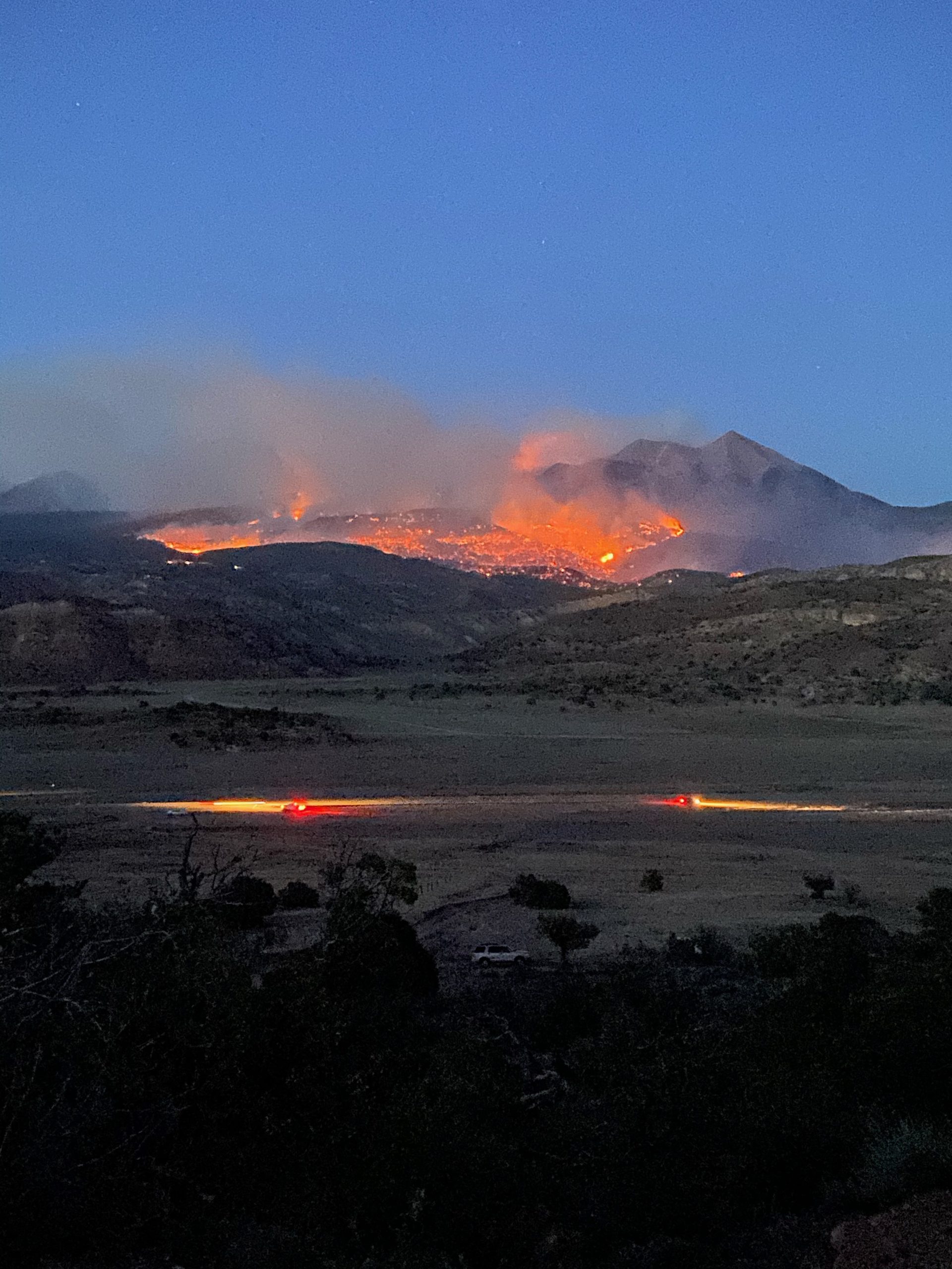
The Pack Creek Fire continues to burn over 5,400 acres on the slopes of the La Sal Mountains south of Moab. While residents of the Pack Creek subdivision were allowed to return, on June 13 the San Juan County Sheriff announced the evacuation of private property east of Geyser Pass after the fire was able to jump the road. Evacuations are from Blue Lake through the Dark Canyon area.
“Failure to evacuate at this time is at your own risk and your safety cannot be guaranteed,” a statement from the Sherriff’s Office reads.
Fire officials fear the fire will spread further due to dry conditions and tough terrain, though more than a hundred additional fire fighting crew members are expected to join the over-250 personnel already fighting the blaze.
“With current weather and fire behavior, we expect large fire growth on the #PackCreekFire,” a post from the Manti-La Sal National Forest cautioned.
“Due to extreme hot and dry conditions, the north part of the fire grew significantly today and crossed a portion of Geyser Pass Road moving into the Oowah Lake area. It is anticipated that the fire will continue moving east into the geyser pass area in between Haystack Mountain and Mount Mellenthin,” a later post read.
Temperatures are predicted to be record-breakingly high in the region throughout the week.
Four primary structures were burned in the Pack Creek subdivision and the fire is burning over 5,424 acres and is at 6% containment as of June 13. For up-to-date information on fire size, check Utah Fire Info.
On June 9, firefighters responded to report of smoke in Pack Creek, southeast of Moab. Strengthened by strong winds, the fire grew through the rest of the day, being first pushed upslope by strong southwest winds into the Manti-La Sal National Forest lands in the foothills below Mt. Tukuhnikivatz. Later that evening, the fire was pushed by downslope winds through the Pack Creek subdivision, the location of dozens of structures and homes, causing residents to evacuate.
The cause of the blaze has been determined to be an unattended campfire close to the Forest Service’s Pack Creek Picnic Area. A thick, active smoke column was visible from town throughout the afternoon, and by evening the sky over Moab was hazy from the smoke. Onlookers on the La Sal Loop Road watched the fire make runs through pinyon and juniper stands until Sheriff’s Officers cleared the road in the evening.
Due to ongoing firefighting activities, extensive and ongoing road closures are in effect. Check updated information before driving in the area.
The Red Cross is helping those must be evacuated. If you are a resident of the Pack Creek area and need assistance, contact the San Juan County Administration building at 435-587-3225 and ask for Natalie Freestone.
Appreciate the coverage? Help keep local news alive.
Chip in to support the Moab Sun News.


