Some information may be outdated.
The Western Regional Climate Center designated all of Grand and San Juan counties, and a portion of Uintah County, as in a “moderate drought,” as of Nov. 21. Prior to the drought listing, the Moab area was categorized as “abnormally dry” for this time of year.
The freakish warm weather has some people worrying, and, if it continues, there will be significant impacts down the road, but keep in mind current temperatures are much the same as they were this time last year, said Randy Julander, snow survey supervisor for the Natural Resources Conservation Service.
Last year’s dry spell was interrupted by a mid-December storm that dumped snow in the La Sal Mountains, replenishing the region’s water supply for another year.
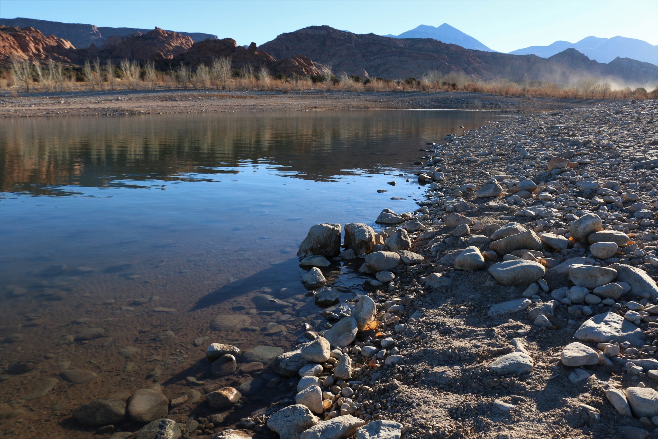
Grand Water and Sewer Service Agency (GWSSA) customers who depend on irrigation water are safe for now as the reservoir level at Ken’s Lake is half full, GWSSA Manager Dana Van Horn said.
“We had a great year last year,” Van Horn said. “We were fed from the snowpack from the La Sal Mountains.”
Whether there will be enough mountain snowmelt to feed the reservoir in the coming year is unknown at this point.
“There basically isn’t any snowpack at all in the La Sals, except for a few inches on random, very high elevation north faces,” said Eric Trenbeath, an avalanche forecaster for the U.S Forest Service’s Utah Avalanche Center.
“I don’t ever remember seeing it like this this time of year,” Trenbeath said.
Moab’s irrigation storage facility, located at the south end of Spanish Valley in San Juan County, held 1,173 acre-feet of water as of Nov. 30, compared to 861 acre-feet in 2013. Van Horn said she has seen some years with less than 300 acre-feet of stored water. (One acre-foot equals about 325,851 gallons of water.)
The GWSSA’s water year runs from Oct. 1 through Sept. 30. Thus far, the current water year does not appear promising, although that could change with a couple of good storms.
“We’re in the first 60 days of the water year,” Van Horn said. “We’re not where we should be. 2018 is looking dry. We’ve had 1 inch of precipitation, while the average is 5.9 inches – 17 percent of average.”
The region has been abnormally dry since May 2, 2017, said Jim Pringle, a National Weather Service warning coordinator meteorologist in Grand Junction, Colorado. He’s responsible for monitoring weather conditions in southeast Utah, as well as western Colorado.
“Even though reservoirs may be full, there can be other indicators,” that warrant a drought listing, Pringle said. “When we look at Utah, we see a 50 percent probability of above normal temperatures,” for the next three months.
Pringle said that it’s no reason to be overly concerned – yet – that it’s part of the traditional cycle of random weather patterns. Moab has experienced moderate droughts many times over the years.
“It comes and goes,” Pringle said.
Above-normal temperatures are typical of the current La Niña weather conditions the region is experiencing, he added. Two years ago, the area was in an El Niño pattern.
“It varies year to year,” Pringle said.
Heidi Redd, whose family operates a cattle ranch with The Nature Conservancy – as a climate change research center – in Indian Creek, said she’s experienced numerous drought cycles in the 50 years she’s been a rancher.
“The Four Corners area has always been a place where you never can completely rely on the weather,” she said. “There have been droughts ever since the ancient Anasazi packed up and left.”
And while the current weather conditions are serious, she said, it’s no more so than in past times, and you adjust accordingly.
“We have not had to cut the herd,” like they’ve done in the past during periods of drought, she said.
A long-term winter outlook shows Moab “sandwiched” between above-normal precipitation patterns in northern Utah, and below-normal precipitation in the south – and Moab could go either way, Pringle said.
There’s a 60-40 probability for a long-term forecast for drier and warmer than normal temperatures in the Moab area, meaning that there is a 60 percent chance of the forecast’s being correct, and a 40 percent chance of its being wrong, said Julander, of the Natural Resources Conservation Service in Salt Lake City. In other words, “anything can happen,” he said.
“It’s why we monitor snow pack throughout the season,” Julander added.
If drought conditions persist, the GWSSA could consider pushing back the date when the lake starts allocating water to irrigation users. Irrigation typically gets turned back on in mid-March, Van Horn said.
She said her agency watches precipitation closely, so it can warn water customers in advance if it appears restrictions may be necessary.
“It’s not a dire situation at the moment,” she said. “But we don’t want to see another month,” without precipitation.
With the current La Niña conditions, prospects for adequate precipitation this winter look “bleak,” Julander said.
“On the other hand, if there is water in the reservoir (like at Ken’s Lake) then drought impacts are mitigated to some extent,” he said. “However, on the other side, we get most of our stream flow from snowmelt. Looking down the line – if we have terrible snow accumulation, will we be able to replace water in the reservoir?”
Possible impacts of a moderate drought include damage to crops and pastures, low water in streams, reservoirs and wells; developing or imminent water shortages; and voluntary water use restrictions, according to the United States Drought Monitor, a partnership of the National Drought Mitigation Center at the University of Nebraska-Lincoln, the United States Department of Agriculture, and the National Oceanic and Atmospheric Administration.
La Sal Mountains
Trenbeath, along with 40-plus other national forecasters, provides regularly updated snow, mountain weather and avalanche information for winter backcountry users such as skiers, snowmobilers and snowshoers.
He told the Moab Sun News that less snow in the mountains actually presents greater risks of avalanches because of the instability it creates.
“That’s because snow that sits around for a long time under cold, clear skies tends to weaken into sugary ‘faceted snow,’” Trenbeath said. “This makes an unstable base for new snow to land on,” and can cause “very destructive” avalanches.
When enough snow falls on the weak layer the entire depth of the snowpack can avalanche down to the ground.
However, because there’s not much snow lying around to turn into a weak layer, Trenbeath said that if it snows, and continues to snow, the risk of avalanche danger will be lessened.
“We’ll know by February what is going to happen,” Julander said. “We’ll have a good assessment of what the snowpack will become in the runoff season, in March or April … There’s still a lot of winter left to come.”
Experts say a good storm or two could end listing
It’s not a dire situation at the moment … But we don’t want to see another month (without precipitation).
Appreciate the coverage? Help keep local news alive.
Chip in to support the Moab Sun News.


