Some information may be outdated.
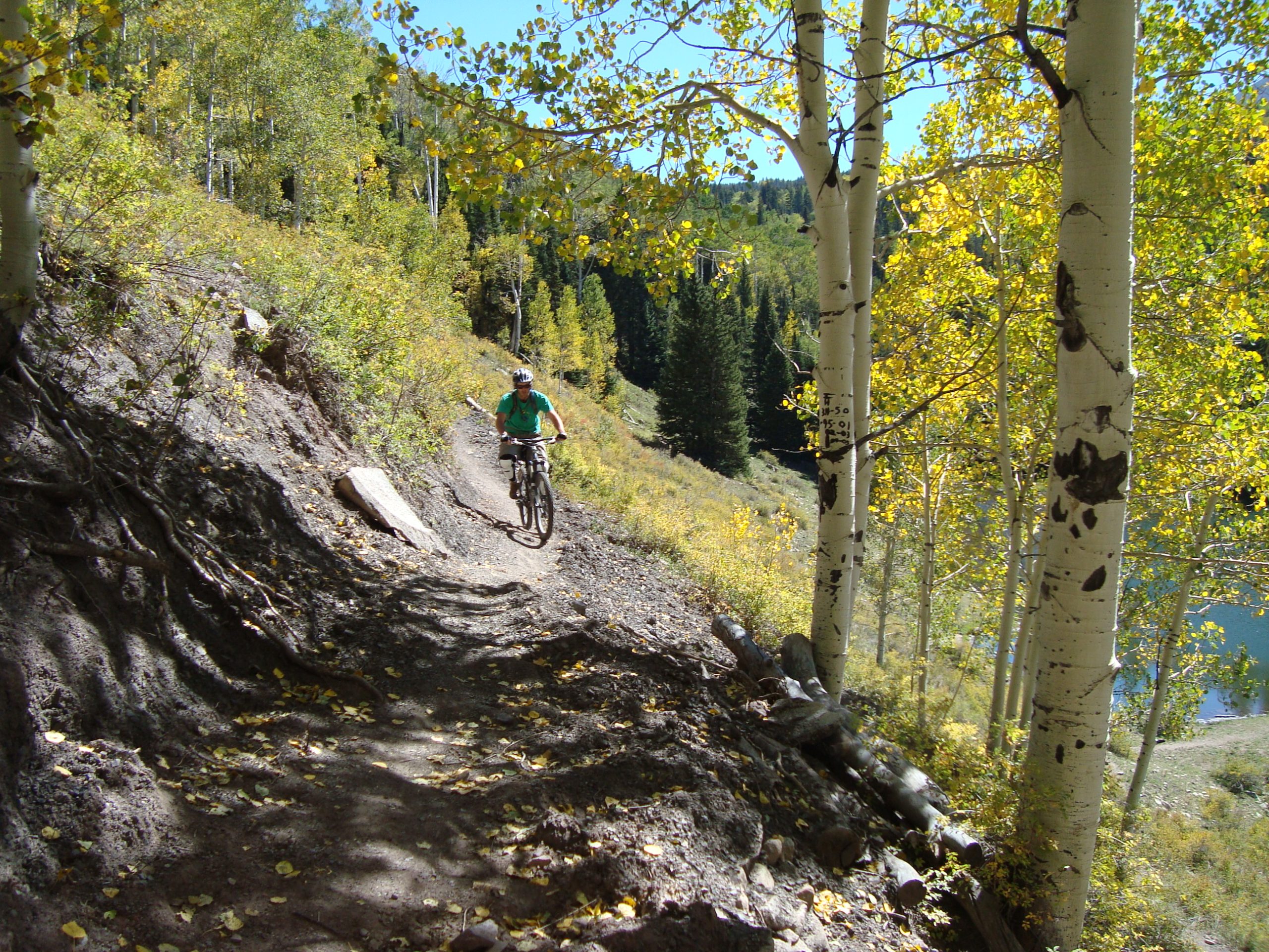
Earlier this month the U.S. Forest Service Moab-Monticello Ranger Districts presented their plan for changes to the non-motorized trail system in the La Sal Mountains. The release of the final version of the plan follows several years of research, planning and public comment. It includes the retention of 60 miles of existing trails, the creation of nearly 30 new miles, and the closure of 3.5 miles of trail.
The forest service’s new plan will also put use restrictions on several trails.
The catalyst for this change in the trail system has been the growing number of people recreating on trails in the La Sals. This rise in use has seen a corresponding rise in conflicts between the different user groups, particularly downhill mountain bikers, uphill hikers and horseback riders.
“I think everyone realizes that the forest service did a pretty good job of mixing up the uses,” said Lynn Jackson of the forest service’s plan. Jackson is the vice chair of the Grand County Council and the council’s liaison with Trail Mix.
The intent of the plan is to create a holistic, long-term vision for the trails that takes into account the ways that the trails have come to be used, said Mike Diem, a district ranger for the Moab-Monticello district.
“Our old trail system was based on uses from maybe 40 or 50 years ago,” he said. “We are starting to see some very different uses on our trails. We are starting to see a little conflict between those uses.”
Most of the recreational trails in the La Sal Mountains were originally mining roads or livestock and big game trails. Some of the trails are still used by ranchers and native animals.
Because of this, erosion and encounters with livestock have also become an issue.
Hunters worry that the increasing number of visitors are scaring away the wildlife, said Brian Murdock, the Moab Ranger District’s recreational trails manager, who is overseeing the project.
In response to these issues the Moab/Monticello Ranger Districts decided to try to work out a plan to remedy these issues.
Two years ago they started talking with different groups of users – hikers, mountain bikers, hunters and horseback riders – to get their input on what they would like to see. When the information was compiled, the ranger district presented a Proposed Action Plan for the La Sal Mountains.
Originally two alternatives were proposed. Alternative No. 1 extended the trail system, restricted certain trails to specific uses, and prohibited commercial mountain bike access to La Sal Pass.
Alternative No. 2 left everything as it was.
The ranger district submitted these options for public comment, and they got it; 43 comments were submitted from individuals, organizations, businesses and government officials.
The comments ranged from wanting even more trails than those proposed to wanting to reduce the number of existing trails in order to mitigate the impact on wildlife. Many who advocated more trails focused on the need for new trails to help bring more people to the area and thus expand Moab’s tourism economy.
“We had a lot of organizations and a very diverse public commenting all the way through,” Diem said. “We were really trying to listen and care about what peoples’ concerns were when we tried to develop the trail system.”
Based on the feedback that they received the ranger district released two additional alternatives.
Alternative No. 3 aggressively expanded the trail system, and Alternative No. 4 went the opposite direction, restricting use of the trails to minimize social conflicts and to ensure the protection of wildlife and watersheds.
Again the public responded with comments. These were reviewed by the ranger district. On Sept. 9 Diem chose to implement a modified version of Alternative No. 2.
“The key thing is we took important pieces from all the alternatives,” Diem said. “The La Sal is not a very big mountain range. You have a lot of different vegetation and habitats that wildlife is depending on in those areas. That played a big role in my decision.”
The new plan will see 24 new trails totaling 28.6 miles. 8.6 of those miles will be open either to only hikers, or to only hikers and horseback rides. The remaining 20 miles will be open to all non-motorized use.
The 3.5 miles of trail that will be closed are on Deep Creek Trail, a trail which Diem said is both seldom used and goes through private land, which the forest service does not have a public easement for.
Portions of South Mountain Trail, Squaw Springs Trail, Warner to Oowah Trails and Hells Canyon Trail will be rerouted to bring their grades up to U.S. Forest Service standards.
Commercial use of the existing Burro Pass Trail, Moonlight Meadows Trail and the new Geyser to Burro Trail will be closed to commercial use until July 1 of each year. This, said Diem, is to protect soils, elk calving and deer fawning. He said that the restriction is instituting a norm already followed by most mountain bike outfitters.
When Diem presented his decision to a meeting that included Trail Mix and many local bike companies at the Grand Center on Sept. 10 no one was thrilled, but no one was livid either, said Sandy Freethey, the Trail Mix committee chair.
“The forest service laid out an ‘everybody got a piece of the pie type thing,’ which generally means that everybody is not exactly happy,” she said. “A lot of the changes by the forest service are small.”
Freethey said that the ranger district will need to work closely with the local mountain bikers as they alter trails like Squaw Springs and Hell’s Canyon because “a lot of local riders don’t want trails that are dumbed down.”
But T.J. Cowern, Poison Spider Bicycles’ service manager, expressed concern that the new plan does not do anything to deal with the issue of livestock in recreation areas.
“They can give ranchers 80-percent of the (La Sal) range,” he said. “It seems like 90-percent of the people go up to recreate in the one corridor near (Lakes) Oowah and Warner. Why can’t they just keep cattle out of that part?”
Diem said the plan was not designed to include livestock.
“We deal with our livestock management through different means,” he said.
Gene Ciarus, the chair of the Grand County Council, said that the forest services’ plan will be beneficial to hunters.
Though he had not reviewed the new plan in detail, Ciarus said that closing off certain trails to commercial bike groups during calving season will help hunters.
“Those two areas are heavy for elk,” he said. “From what I understand I’m supportive of the changes. I think there has to be a balance between bicyclists and hunters and the other people that use it.”
Though the Moab-Monticello Ranger Districts have already decided on their plan, they cannot implement it until the window to legally appeal the decision closes on Oct. 24.
And though Diem hopes to start on implementing the new plan this year, he does not think any serious work will be done until next spring.
“Realistically I think it will take us two to three years to finish the system,” he said. “By doing that we will be enhancing the whole system. I really want to thank everyone that participated in this process that went over three years. We tried to keep it as open as possible.”
Appreciate the coverage? Help keep local news alive.
Chip in to support the Moab Sun News.


