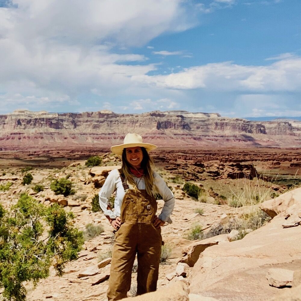
As kids, many of us may have tried digging holes to China — without much success. This week, we speak with someone who digs holes on a larger (though not deeper) scale: soil scientist Kristi Mingus, who’s mapping soils in the San Rafael Swell and Emery County for the Natural Resources Conservation Service.
We learn why Dr. Mingus is mapping, how she decides where to map, and why soil science is “that thing I was missing that I didn’t know I was missing.”
Science Moab: What’s the goal of mapping all these remote soils in the US?
Mingus: It helps people understand how to best use the land. You can use the soil map to decide the best place to build a building, or to decide what to grow in certain areas. If you’re curious what the native vegetation should be on a certain soil type, you can get insight into that. If you want to use the map for rangeland management, you can figure out what vegetation the land should be producing if it’s healthy.
Science Moab: How do you decide where to map, and what aspects of the soil are you examining?
Mingus: Often, we’ll look at specific landforms. So if we’re going to a hill, the soil could be different at the top of the hill, the shoulder, the sides, and down at the bottom. All those different landform positions have different soil-forming factors, so we’ll test them all.
First, we consider soil color, which can indicate geology, mineralogy, and organic matters. For example, topsoil is often darker, and soils will get lighter as you go down, maybe because there’s more salt accumulation lower. Texture is another aspect: percentages of the different particle sizes, which are defined as sand, silt and clay. Clay is the smallest particles, silt is mid-size, and sand is the largest. Texture is important to understand erosion and potential water infiltration.
We also describe soil structure. Where soil is really compact, you get this plate structure, versus something granular where we have little round balls forming. Finally, we measure rock fragment percentage; salt content; and soil pH.
Science Moab: How do you physically test the soil?
Mingus: When we’re out there, we dig soil pits that are five feet deep, or until we hit bedrock. Those soil pits are full of layers, which we call “horizons.” So we’ll figure out where those horizons are by observing changes in color, texture, and those other aspects. At the end of the field season, we’ll compile everything and determine a range of characteristics for that area.
Science Moab: What are these data used for?
Mingus: First, our maps are published in the Web Soil Survey, which is publicly available. I recommend checking it out. Otherwise, the answer depends really on the location. I’m currently working on Bureau of Land Management and Forest Service lands. Federal agencies use that data, because they’re constantly being asked, “Can I do this project on this land?” and they have to make decisions based on the resources there. Having a soil map can clue them into areas of sensitivity.
Science Moab: What do you mean when you refer to soil health?
Mingus: That’s really location-dependent. On agricultural lands, we’ll use that term “soil health” to refer to soils that are being replenished and not degraded. When you’re talking about the desert, lack of health is related to a lot of usage, whether that’s from people walking off-trail in sensitive areas, or a certain area that has been hit really hard with grazing.
Science Moab: What do you like most about soil science?
Mingus: I feel lucky to have the opportunity to study something for its own sake. I just get to go out, dig holes, and try to figure out why a certain soil exists in a certain place. It’s like a history book. A lot of it is solitary time where you’re out in the middle of nowhere by yourself doing this work, and I feel like I’ve developed a stronger connection to the landscape than I ever thought was possible. It’s that thing I was missing that I didn’t know I was missing. It sparked my curiosity about the natural world.
Science Moab is a nonprofit dedicated to engaging community members and visitors with the science happening in Southeast Utah and the Colorado Plateau. To learn more and listen to the rest of Kristi Mingus’s interview, visit www.sciencemoab.org/radio. This interview has been edited for clarity.