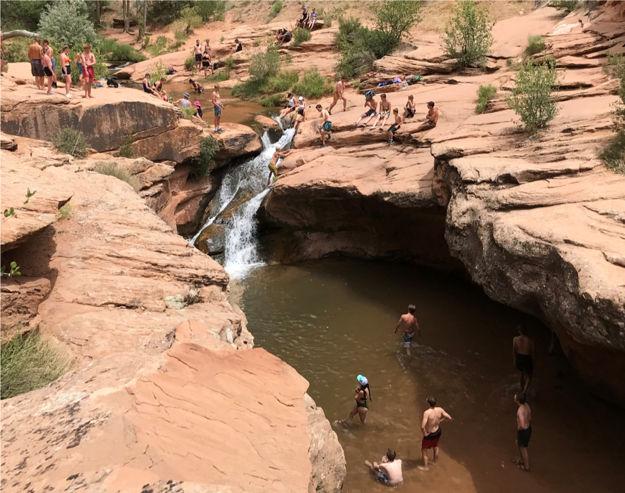
The Mill Creek area, on the southeast end of town, is a beloved place for residents to go hiking, take a swim or have a family picnic. In recent years, however, an increase in the number of people visiting the spot has led to congestion, limited parking and increased human impact on the ecology of the area. Many questioned how to protect the place so many love.
“A lot of times with this kind of situation, people don’t want things to change,” said Kara Dohrenwend, “but here, it seems pretty clear that people understand that something has to be done to protect the canyon.”
The Mill Creek Community Collaborative released a survey in September 2020 presenting four proposals to help control the rapidly growing usage of the Mill Creek area. The survey is the most recent step by the collaborative organization, which has been working to develop solutions since 2018. Dohrenwend’s nonprofit, Rim to Rim Restoration, is part of the effort.
Nearly 400 people responded to the survey which presented plans running from essentially taking no action to moving the designated parking to another area. The other two proposals involved improving the existing parking area at the end of Powerhouse Lane.
Many survey respondents indicated a preference for moving the existing parking area for Mill Creek Canyon to Potato Salad Hill, off Sand Flats Road. This option proposes paving and improving the existing road and adding informational kiosks and public toilets. An accessible trail into Mill Creek would be developed to run from the parking area.
Rather than improving the parking along Powerhouse Lane, the preferred option would reserve the road for pedestrian and bicycle access from April through October. The Powerdam and Potato Salad Hill areas would be connected with a pedestrian and bicycle bridge over Mill Creek.
Throughout the survey, people supported minimizing impact to other areas of Mill Creek and worried that limiting access to the main Mill Creek area would simply push visitors to other access points.
“If things change at the Powerdam will that just put more pressure in another neighborhood in another place?” asked Dohrenwend.
“Early on in this process there was a joke about whack-a-mole in management: when you make a change here, then it just pushes the use over there and creates another problem,” said Dohrenwend. “We’re trying to be sensitive to that and think about some of the other ways to get into Mill Creek.”
The survey showed support for Mill Creek becoming a fee area, although the details of how the fee would be implemented are unclear. One common request was that locals should be exempt or have a reduced cost, so as to put the cost burden on visitors. There was also less support for areas above the Powerdam to be permitted.
“I think there was pretty strong support on [implementing fees] in the survey,” said Betsy Byrne, the National Park Service Rivers, Trails, and Conservation Assistance facilitator, who has been coordinating between the many involved parties.
Currently, the Mill Creek Community Collaborative is working on distilling the community desires shown in the survey into detailed recommendations for the many land managers representing the tangle of city, county, federal and private land owners in the Mill Creek area.
“We’re still trying to kind of think through what some of the conflicts might be there and how we might make it work best for everyone,” said Byrne. “Hopefully, once we have that all hammered out, we can present it back to the public, and people can see what those final recommendations are.”
“This is a community-supported planning process, so we do want the community to be involved as much as possible,” said Byrne.
According to officials, any recommendations will take time to be approved and implemented by the different agencies. For instance, Byrne noted that creating a fee collection point can be a multi-year process at the Bureau of Land Management.
Both Byrne and Dohrenwend are hopeful about the eventual solutions for Mill Creek access. Between federal funding and collecting use fees for the area, they see real solutions to improving access and mitigating impact.
“I think there’s some hope that with the Great American Outdoors Act, there might actually be some ways that BLM and others could put in for funding to help with some of the projects that need to be done,” said Dohrenwend.
One major impact to the area’s ecology is the many informal, social trails created by people walking through riparian areas. According to Dohrenwend, future plans for the area include clearly making one official trail. Many archeological sites in the area still need to be cataloged and the trail has to be designed to limit damage to these sites. All of this takes time.
Both Byrne and Dohrenwend relayed that they expected many of the actual improvements to start happening by 2022.
Readers can see the results of the survey at https://moab84532.wixsite.com/mccc/post/2020-community-input-survey
Land managers look to survey for guidance on managing Powerdam area


